Driving the Icefields Parkway, Canada | Best Lakes, Falls & Hikes
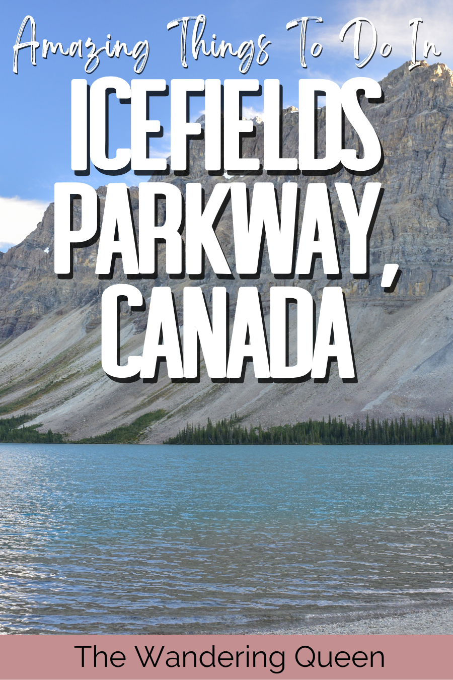
Stretching all the way from the town of Jasper to the turnoff onto the Trans-Canada Highway near Lake Louise, the Icefields Parkway is like no other. With its otherworldly glaciers, towering mountains, picturesque lakes, and unforgettable waterfalls, this is one of the most scenic roads in the land.
Add the fact it offers stops to some of the best trails in Banff National Park and Jasper National Park, and you’re in a hiker’s paradise. You won’t even realize you’ve covered 144 miles (232 km) during your trip, and you may even be inclined to do it all again the next day.
Simply put, there are loads of things to do and see during your Icefields Parkway, Canada, drive. That’s why this guide covers everything you need to know about the best places to stop, what to look out for, and how to prepare for your trip.
Disclosure: This post contains affiliate links. If you click one of them, I may receive a small commission (for which I am very grateful for) at no extra cost to you.
Banff, Yoho, and Jasper National Parks
Related Posts
The Best Things to See & Do During an Icefields Parkway Drive
From the best hikes in Banff to the stunning Lakes of Jasper National Park, let’s have a look at the top things to do along Icefields Parkway, Alberta.
4 Best Lakes to Visit Along the Icefields Parkway
To kick things off, let’s dive into the wonderful world of the Canadian Rockies glacier-fed lakes nestled between some truly stunning mountain peaks.

PS: An honorable mention also needs to go out to Lake Louise. Although it’s technically not along the Icefields Parkway route, it’s no more than a five-minute drive along the Trans-Canada Highway. It is definitely worth adding to your to-do list during this road trip.
Herbert Lake
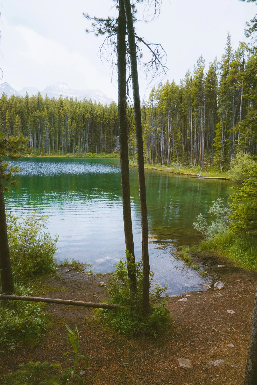
Located just six minutes from Lake Louise and the turnoff from the Trans-Canada Highway, Lake Herbert marks the perfect start to your Icefields drive. The views are simply breathtaking, with the mountain range of Yoho National Park peering over the top of a deep emerald-green lake and lush coniferous forest.
While there is a 1-mile (1.6 km) Herbert Lake Trail that loops around the lake, this hike is not necessary. The best views you’re going to get are by the parking lot.
So save your energy for one of the more spectacular hikes further down in this guide.
Bow Lake
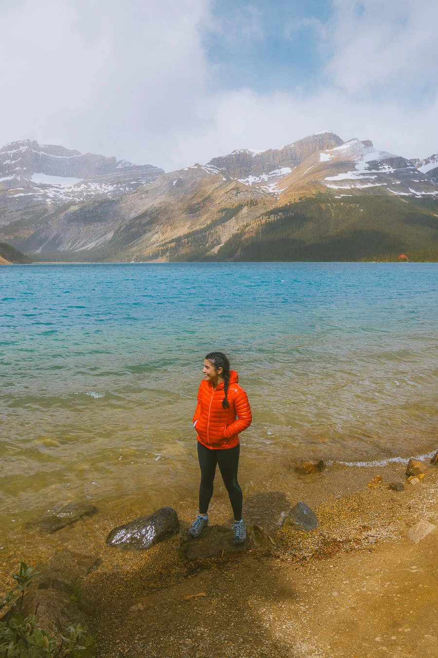
This is another one of those locations where all you need to do is stop, relax, and soak up the mesmerizing views.
The Lodge at Bow Lake is what sets Bow Lake apart. Grab a bite to eat at The Lodge, choosing between Hanging Glacier Cafè or the Elkhorn Dining Room. Regardless of where you eat, the views of this baby blue lake, paired with Mt Thompson and Vulture Peak overhead, are sure to stir up some long-lasting memories.
Peyto Lake
- Mileage: 1.5 miles (2.4 km) loop
- Elevation Gain: 305 ft (93 m)
- Difficulty: Moderate
- Trail Guide: Link
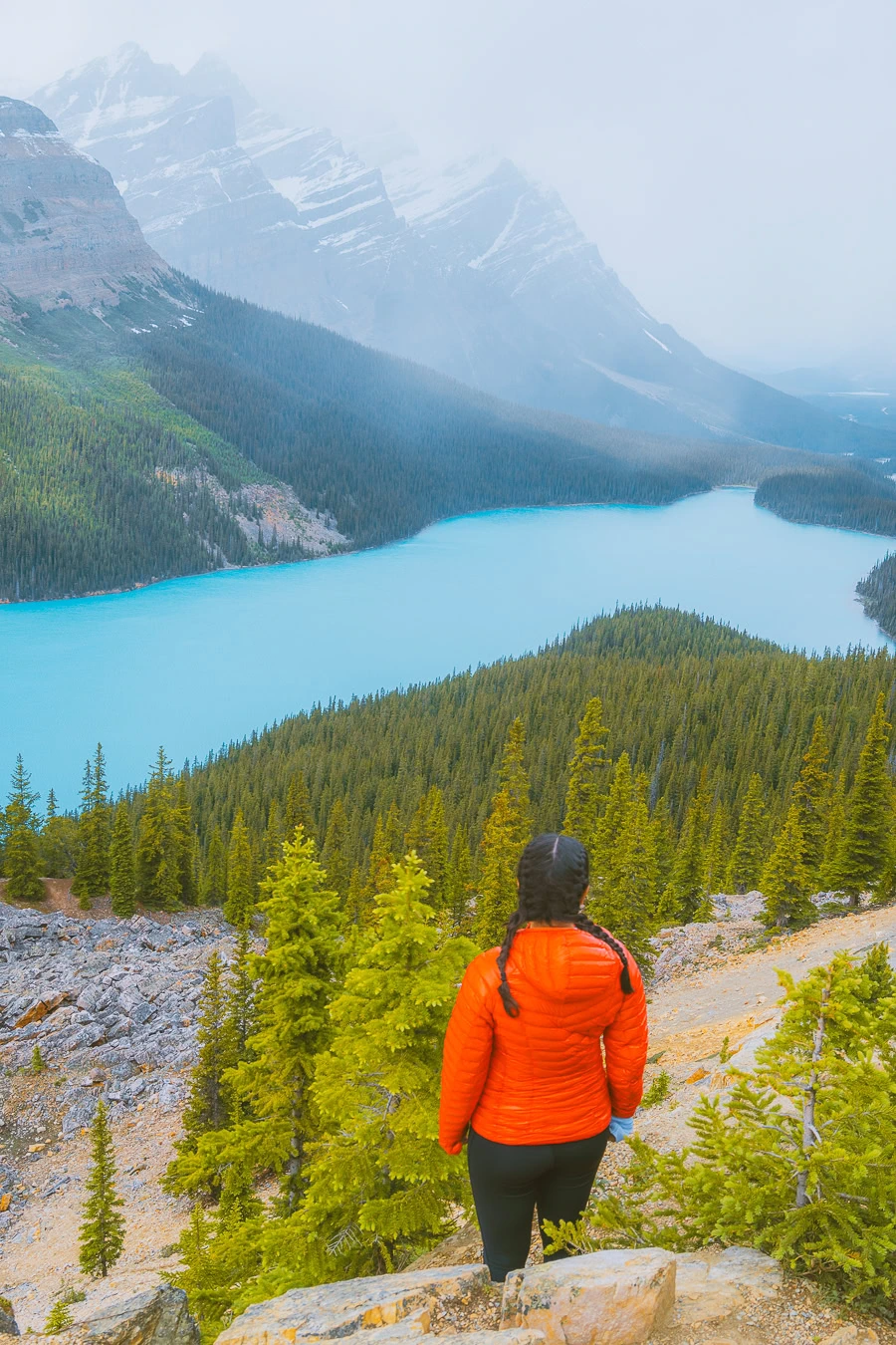
Now, this is one that you definitely need to do the hike for, as it offers you not one but three stunning viewpoints.
Starting at the parking lot, you’ll walk past the information sign about Bow Summit. From there, you’ll continue straight along the Valley View path before reaching the first vista. You’ll continue along the path — stay straight, as the right fork will take you along the Caldron Peak Trail.
The Panoramic Viewpoint and third stop aren’t too far away from each other, but each offers stunning vistas of Peyto Lake. With the dramatic Caldron Peak towering over the azure blue waters, there’s no doubt you’ll snap plenty of photos.
Waterfowl Lakes
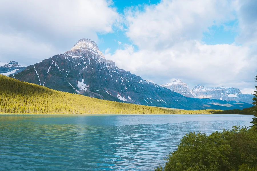
The last of the must-see lakes along the Icefields Parkway scenic drive is the Waterfowl Lakes. The upper and lower lakes offer jaw-dropping scenery as their crystal-clear waters beautifully reflect the surrounding mountains.
The Waterfowl Lakes Campground splits the two lakes, and if you want a great place to spend the night under the stars, this is it. The lower lake is slightly quieter and has a lovely bench where you can relax and soak up the views of the White Pyramid Peaks.
Download my free Outdoor Photography Guide
5 Stunning Waterfalls to Admire Along the Icefields Parkway
With the awe-inspiring lakes of the Icefields covered, it’s time to catch a glimpse of the best waterfalls in the area.
Athabasca Falls
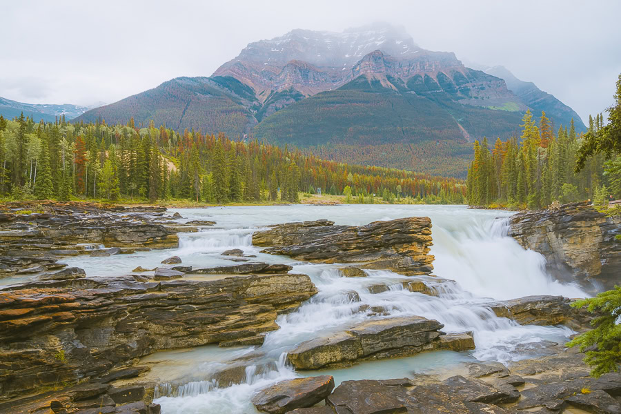
Possibly one of the most unforgettable Jasper attractions you’ll see during your road trip is Athabasca Falls. It may not be the highest fall in the Canadian Rockies (only 75 ft/23 m high), but the Athabasca River makes it one of the most powerful.
Cascading over a hard layer of quartzite, the falls have carved intricate shapes and potholes into the soft layer of limestone below. The area has several well-maintained paths leading to incredible views of the falls and Mt Edith Cavell in the distance.

Top Tip: The falls often spray a fine mist over the path, which can be slippery, so it’s best to wear shoes with a good grip.
Sunwapta Falls
- Mileage: 2 miles (3.2 km) out-and-back
- Elevation Gain: 479 ft (146 m)
- Difficulty: Moderate
- Trail Guide: Link
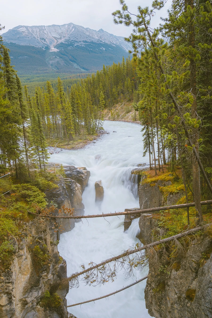
While you can just hop out of the car and enjoy the views near the parking lot, you’d be remiss not to hike to Lower Sunwapta Falls.
The upper falls feature a distinct island of trees splitting the river in half just before the falls cascade 60 ft (18 m) down. The lower falls, on the other hand, have three drops for you to admire.
There is also a footbridge along the trail that makes for a fantastic vantage point to snap some stunning photos of the river cutting through the gorge below.
Panther Falls
With a 216 ft (66 m) drop, Panther Falls is one of the more dramatic falls in Banff National Park. That said, when you stop to see Panther Falls, you’ll be getting two epic waterfalls in one stop, as you’ll also get to see Bridal Veil Falls while you’re there.
The viewpoint for Panther Falls is a short 0.8-mile (1.3 km) trek with plenty of switchbacks to help make it a more moderate hike. You’ll come across Panther Falls first, where the water rushes down into a rocky pool below.
Bridal Veil Falls isn’t much farther on from there, where you’ll be able to admire the 400 ft (122 m) waterfall in all its glory. Bridal Veil is surrounded by far more vegetation, making it the prettier of the two falls.
Tangle Creek Falls
Next up on the list of waterfalls to visit is Tangled Creek Falls. Its name explains what you’re going to see perfectly. The falls weave through the terraced rockface, creating what looks like a tangled lattice of white water.
Getting to the falls is also extremely easy, as it’s a very short walk from the parking lot. In winter and most of spring, the falls freeze over, creating a white blanket over the rock face. Come summer, the falls burst to life with a tapestry of streams cascading down the valley.
Mistaya Canyon Waterfall
- Mileage: 1.2 miles (1.9 km) loop
- Elevation Gain: 272 ft (83 m)
- Difficulty: Moderate
- Trail Guide: Link
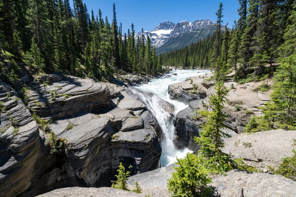
Starting at the parking area, it’s a short walk to the canyon, where the Mistaya River flows through its center.
From the footbridge, you’ll be able to peer down below and admire the true power of water. The river and waterfall have carved several arches and unique rock formations into the soft limestone below.
Before heading back to the car from the footbridge, enjoy the scenic trek along the Mount Sarbach Route for a welcome reprieve from hours of driving.
6 Lovely Banff Icefields Parkway Glaciers You Can’t-Miss
A lot of the lakes and waterfalls in the area are fed by centuries-old glaciers, and here are the ones that will truly stand out during your road trip.
Stutfield Glacier Viewpoint
No more than a five-minute drive from the Columbia Icefield Skywalk, you’ll find the stunning viewpoint of Stutfield Glacier. Resting between Stutfield Peak and Mt. Kitchener, the glacier looks like a majestic white cloud cast over the mountainside.
Stutfield Glacier is like all the other scenic spots along this road with pull-offs. The little parking area offers the perfect vantage point to stop and admire the scenery around you.
Athabasca Glacier
- Mileage: 0.9 miles (1.4 km) out-and-back
- Elevation Gain: 197 ft (60 m)
- Difficulty: Moderate
- Trail Guide: Link
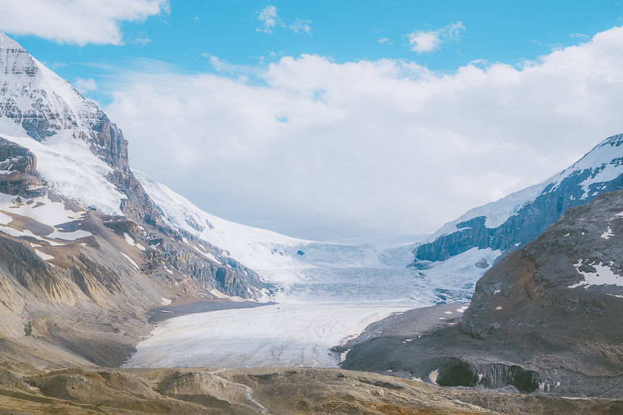
There aren’t many cases where you walk straight up to the toe of a glacier without needing to break a sweat. That said, Athabasca Glacier is one of those, as all you need to do is trek for 0.45 miles (0.7 km) to reach the glacier base.
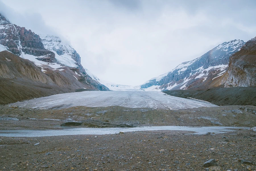
Starting at the parking area, where you may see a few other vehicles, it’s a short uphill trek along the Columbia Icefields Route. Once at the base, you can gaze in amazement at the glacier, which is approximately 3.7 miles (6 km) long.

Top Tip: If you’re quiet enough, you may even hear the cracks and pops of the glacier as it moves down the valley.
Crowfoot Glacier
Crowfoot Glacier was originally named for its three-lobed shape — the lower spur melted away in the 1940s. Despite this, it’s still a fantastic site to behold from the viewpoint at Bow Lake.
The glacier is wedged between Vulture Peak and Bow Peak, helping create its unique shape. It’s beautiful to view from afar and snap some photos of Bow Lake in the foreground and the glacier rising above.
Bow Glacier
- Mileage: 5.5 miles (8.9 km) out-and-back
- Elevation Gain: 925 ft (282 m)
- Difficulty: Moderate
- Trail Guide: Link
While you may not be able to see Crowfoot up close, you sure can with Bow Glacier. The trail leads you all the way up the valley to Bow Glacier Falls.
The trail can be quite muddy in the lower section during summer, so be aware of that. Once you’ve gotten past the mile point, though, the hiking conditions get a lot better. That said, the elevation gain does begin to pick up, so it’s a long trek all the way to the top.

Top Tip: Don’t turn back once you reach the falls. Continue onward to Iceberg Lake, where stunning blue waters compliment the rocky terrain and white glacier perfectly.
Wapta Glacier
Situated above Bow Glacier and just a bit further west, you’ll find Wapta Glacier. This is a largely icy landscape with plenty of flat terrain to admire. It truly is a site to behold and something you can only really see on a guided glacier trek.
If you do opt to join a guided tour of the Wapta Icefield, most of these are multi-day treks, going from hut-to-hut.
Peyto Glacier
One of the other spots you’ll trek to on a guided glacier tour is Peyto Glacier. This glacier is situated between Mt Jimmy Simpson, Peyto Peak, and Mt Thompson. The glacier is melting at an alarming rate, and many are worried it may disappear altogether in the not-so-distant future.
So if you want to see this magical icy world before it goes away, it’s best to visit it sooner rather than later.
Get our free Banff Hiking Checklist
When you join my newsletter!
10 Top Hikes on the Icefields Parkway
Now it’s time to get stuck into all the fun stuff. Here are the top 10 hikes along the Icefields Parkway, with several Jasper trails and a couple of Banff National Park mentions sprinkled in there.
Parker Ridge Hike
- Mileage: 4 miles (6.4 km) out-and-back
- Elevation Gain: 1,125 ft (343 m)
- Difficulty: Moderate
- Trail Guide: Link

This two-and-a-half-hour trail offers incredible vantage points of hanging valleys and the Saskatchewan Glacier. The trail is pretty much right in between Jasper and Lake Louise, with an hour and a half drive to either town from the trailhead.
As for the trail itself, you’ll begin with some steep switchbacks through a stunning forest before reaching a bench with great views. Not too much further on, there’s another fantastic vista with 360-degree views.
Many turn back there, but if you’re an experienced hiker who likes a challenge, continue onward to the end of the trail. From there, you’ll be met with unforgettable views of the Saskatchewan Glacier in all its glory.
Wilcox Pass Hike
- Mileage: 7.2 miles (11.6 km) point-to-point
- Elevation Gain: 1,348 ft (411 m)
- Difficulty: Hard
- Trail Guide: Link

Taking between three-and-a-half and four hours to complete, Wilcox Pass is a trail packed with magical scenery and plenty of scrambling. Starting at the Wilcox Creek Campground, you’ll head northwest all the way to Tangle Creek.

You’ll have a number of scrambles to contend with, the most notable being at Wilcox Peak and Tangled Ridge. Despite its challenges, this point-to-point trail is a fantastic half-day hike showcasing the myriad of colors this region has to offer when the summer wildflowers bloom.
Valley of Five Lakes Trail
- Mileage: 3.1 miles (5 km) loop
- Elevation Gain: 541 ft (165 m)
- Difficulty: Moderate
- Trail Guide: Link
It’s not often you get to see five beautiful lakes all in one hike, but that’s exactly what you can do on this trail. It’ll take you just over two hours to complete as you trek clockwise from Lake 1 to Lake 5.
You can even swim in these chilly waters in summer if you’re up for it. This does make it a very popular trail in summer, meaning more cars in the parking area and a more congested hike. Despite this, summer is the best time to enjoy the trail, but if you hike during sunrise, you may be able to capture the beauty of the golden hour over these stunning lakes.
Glacier Lake Trail
- Mileage: 10.6 miles (17.1 km) out-and-back
- Elevation Gain: 2,684 ft (818 m)
- Difficulty: Hard
- Trail Guide: Link
For all those hardcore hikers out there who love a good day hike, the Glacier Lake Trail is the one. Due to its difficulty and length, many make it a multi-day hike, spending the night at the campsite alongside Glacier Lake.
The hike has a steep incline as you walk alongside Survey Peak to get to the incredibly blue lake at the trail’s end. Along the way, you’ll pass over two bridges and enjoy some simply stunning views of the Howse River.
Mt Edith Cavell Trail
- Mileage: 4.6 miles (7.4 km) loop
- Elevation Gain: 1,821 ft (555 m)
- Difficulty: Hard
- Trail Guide: Link

You’ll need to drive along a narrow 8.7-mile (14 km) road from Icefields Parkway to get to this trailhead, but it’s more than worth the effort. While the trail is strenuous and pretty much all uphill, the views get better with each step you take.
The first notable stop of this three-and-a-half-hour trek is the viewpoint overlooking Cavel Pond and Angel Glacier in the distance. You’ll want to take it slow as you trek along the rocky moraine all the way up to the Edith Cavel Meadows, which bursts with color thanks to the summer wildflowers.
Chephren Lake Trail
- Mileage: 5.1 miles (8.2 km) out-and-back
- Elevation Gain: 902 ft (275 m)
- Difficulty: Moderate
- Trail Guide: Link

Starting at the Waterfowl Lakes Campground, this is a lovely two-and-a-half-hour trek winding through a stunning coniferous forest. The trail can be muddy as it follows the valley floor. While the elevation isn’t too bad, the path is quite uneven, so you’ll want to watch your step.
If you don’t mind getting some muddy boots, then the scenery at the end of this trail will leave you inspired. The tranquil turquoise waters are incredibly stunning with Mount Chephren and Howse Peak creating the perfect amphitheater for this lake.
Cirque Lake Trail
- Mileage: 5.6 miles (9 km) out-and-back
- Elevation Gain: 1,174 ft (358 m)
- Difficulty: Moderate
- Trail Guide: Link
For three hours of pure bliss, the Cirque Lake Trail is yet another fantastic trail starting at the Waterfowl Lakes Campground. It’s a super popular trail as well, so you’ll want to get here early to avoid the crowds.
The path follows alongside Upper Waterfowl Lake for much of the trek before veering right up the mountainside. It’s difficult to explain just how breathtaking the lake looks, with the Midway, Stairway, and Aries Peaks dominating the skyline.
Helen Lake and Cirque Peak
- Mileage: 10.2 miles (16.4 km) out-and-back
- Elevation Gain: 3,747 ft (1,142 m)
- Difficulty: Hard
- Trail Guide: Link
One of the best things for an experienced hiker to do in Banff is tackling this mammoth hike, which will take just under five and a half hours to complete. The first 1.8 miles (3 km) consists of a gradual incline through a forested region before rounding Crystal Ridge.
The incline doesn’t end there as you trek uphill to Helen Lake, which is the perfect place to rest. Roughly 4.3 miles (7 km) into the trek, you’ll reach the scrambling section, where you’ll need to be careful. The scrambling section is all uphill and lasts just under a mile before you reach the summit of Cirque Peak.
Beauty Creek Trail
- Mileage: 2.4 miles (3.9 km) out-and-back
- Elevation Gain: 456 ft (139 m)
- Difficulty: Easy
- Trail Guide: Link
If you want an easy hike for the entire family, then the hour-long trek to Beauty Creek is a great option. Feeding into the Sunwapta River, this trail follows alongside Beauty Creek.
Along the way, you’ll pass by several waterfalls offering fantastic lookout ledges for snapping that perfect photo. Just remember to wear shoes with good grip, and the path often gets wet and slippery due to the mist from the waterfalls.
Sunset Lookout Trail
- Mileage: 5.1 miles (8.2 km) out-and-back
- Elevation Gain: 2,191 ft (668 m)
- Difficulty: Hard
- Trail Guide: Link
Wrapping up this list of epic hikes is possibly the most scenic of them all — the Sunset Lookout Trail. Starting near the North Saskatchewan River, this almost four-hour trek travels up the ridge to the Sunset Fire Lookout.
It’s quite challenging and has a fairly steep incline, so be sure to take breaks whenever you need to. That said, as the name suggests, it’s best to head up this trail for sunset. Views of the North Saskatchewan River carving its way through the Canadian Rockies as the sky lights up in a tapestry of sunset colors is honestly an experience like no other.
Your Icefields Parkway Map
Here’s your Icefield Parkway map, covering all the lakes, falls, and trails mentioned in this guide.
Best Tours of Icefields Parkway

While doing it alone is always fun, here are some of the top tours of the area so you don’t need to think about every detail of your trip.
- Athabasca Glacier and Columbia Icefield Day Trip — You’ll see Bow Lake, Columbia Icefield Skywalk, Waterfowl Lakes, and Athabasca Glacier, just to name a few stops along this tour. >>>Book Your Tour
- Glaciers, Mountains, Lakes, Canmore, and Banff Tour — If you’re based in Calgary and want a day filled with glacial lake visits and scenic viewpoints, check out this option. >>>Book Your Tour
- Columbia Icefield Skywalk and Ice Explorer Ticket — Drive onto the Columbia Icefield, drink fresh glacial water, and explore the region like never before. >>>Book Your Ticket
- Icefields Parkway and Abraham Lake Ice Bubbles Tour — From ice skating on top of Abraham Lake to visiting Bow Lake and Peyto Lake, there’s plenty to look forward to here. >>>Book Your Tour
- Icefields Parkway Audio Driving Tour — If you’re a do-it-yourself kind of person, then this audio driving tour is a great option. This tour highlights every lake, waterfall, glacier, and mountain peak worth seeing as you drive. >>>Book Your Ticket
Best Time to Drive the Icefields Parkway

The best time to drive the Icefields Parkway is undoubtedly between June and September. This would fall during the summer months when the weather is better, the falls are in full flow, and there are lower chances of road closures.
Although the Icefields Parkway stays open year-round, the snowy period between November and April does cause some of the off-roads to close. Summer to early fall also offers far more opportunities to see the area’s wildlife and wildflowers blooming.
Tips for Exploring the Columbia Icefield Parkway

- Visit the Icefield Centre — Whichever direction you plan to drive this route, be sure to stop at the National Park visitor centers before you do. If in Jasper, the Park Information Center is on 500 Connaught Drive. For those traveling from Banff, the Lake Louise Visitor Centre is next to the Samson Mall.
- Get a National Parks Pass — While the road itself is free, you will need a permit as it passes through two national parks. You can purchase day passes online via Banff Lake Louise or Jasper Travel.
- Stay up-to-date on road closures — While Icefields Parkway won’t close, several of the smaller roads leading off Icefields will close. Be sure to stay up to date with the road conditions on the Icefields Parkway website.
- Check weather conditions — This is especially important during winter and spring, as hiking routes around Icefields Parkway are prone to avalanches and closures. Stay up-to-date on avalanche conditions with Avalanche Canada.
- Practice wildlife safety — The Icefields Parkway is home to several large animals, including grizzly and black bears, elk, and bighorn sheep. As such, don’t approach wildlife like this, and always engage with animals safely.
Claim your FREE Hiking Checklist
Ready to start hiking? Grab my free hiking checklist and never forget anything at home!
Packing List for Exploring the Canadian Rocky Mountains
It tends to stay cold in the Canadian Rocky Mountains, even in summer. So be sure to dress warm and pack:
- Warm hat — To keep your head warm on those breezy days. >>>Buy this beanie
- Rain jacket — It can get wet, especially near the waterfalls. >>>Compare these jackets
- Fleece jacket/jersey — Bring a fleece jacket for that extra layer of warmth. >>>Check out this jacket
- Long sleeve shirts — A warm Merino base layer is always a good idea. >>>Get this shirt
- Quick-dry pants — Fast-drying pants are a must, especially when hiking in wet weather. >>>Buy these pants
- Hiking boots — Comfortable, quality hiking shoes should always be a priority. >>>Compare these shoes
- Wool socks — Stop your toes from freezing with a quality pair of Merino socks. >>>Get these socks
- Waterproof daypack — Make sure all your valuables stay dry during your hikes. >>>Compare these daypacks
- Gloves — There’s no point in covering up every part of your body except for your fingers, which arguably feel the cold the most. >>>Get these gloves
- Water bottle — Always remember to stay hydrated, whether driving or hiking. >>>Buy this hydro flask
Where to Stay Along the Icefields Parkway, Banff
While there are plenty of places to stay in Banff, Lake Louise is the closest destination, with some amazing lodgings on offer.
Luxury | Fairmont Chateau Lake Louise
You won’t find a better 5-star restaurant with views of Lake Louise than the Fairmont Chateau. With six on-site restaurants, family-sized rooms, a heated indoor swimming pool, and a luxurious spa on offer, Fairmont really has left no stone unturned. Plus, it’s a short 10-minute drive from the Icefields Parkway. >>>Check Availability
Mid-Range | Baker Creek By Basecamp
For something slightly more affordable, Baker Creek offers lovely wooden cabins for you to call home. It also offers family-sized rooms, and albeit rustic, you’ll have a fully kitted kitchen or kitchenette at your disposal. And to put the cherry on top, it’s just 15 minutes from Icefields Parkway. >>>Check Availability
Budget | Mountaineer Lodge
While the Mountaineer Lodge is an extremely cost-effective option, it still ticks all the boxes of a luxury stay. From the plush bedding and spacious rooms to the communal kitchen and indoor hot tub, there really isn’t much to falter. To make things even better, it’s one of the closest lodgings to Icefields Parkway, with a short 3-minute drive. >>>Check Availability
FAQs About Icefields Parkway & the Canadian Rockies
Before you head off on one of the best drives in the world, here are some quick answers to popular questions about the Icefields Parkway.
How Long Does It Take to Drive the Icefields Parkway?
Driving straight through Icefields Parkway without stopping will take around three hours. However, you will most likely spend the day exploring what the road has to offer.
Does Icefields Parkway have an Entrance Booth?
Yes, there are booths on either end of the highway where you’ll need to show your National Park Pass to drive along the road.
What Is the Most Scenic Part of the Icefields Parkway?
It’s hard to choose, but Peyto Lake is the most visited and photographed area along the road.
Does the Icefields Parkway Close?
Fortunately, the Icefields Parkway is a part of the highway system and stays open year-round. That said, the off-roads to specific lakes and hikes are prone to being closed during the snowy period from November to April.
Final Thoughts on Exploring the Icefields Parkway in Canada
There you have it, a complete guide to the unforgettably breathtaking Icefields Parkway. Be sure to add this drive to your Canadian Rockies itinerary, and don’t be afraid to share your amazing adventure with the world.
Until next time, happy hiking!

