The 26 Best Hikes in the World | Most Beautiful Hiking Trails
Nothing beats the feeling of crisp fresh air in your lungs as you make your way on meandering trails with beautiful surroundings. If you’re looking to immerse yourself in some of the most beautiful scenery, hiking trails are a great way to do so.
The best thing about the great outdoors is that there are so many places to explore. From interesting rock formations in icy Norway to the scenic Appalachian trail, there’s something for everyone.
Many of these journeys might be multi-day trips. But, there are also day hikes out there that don’t require you to be an athlete. These best hikes in the world are waiting for you to traverse them.
Without taking much of your time, take a look at the best hiking trails in the world.
Disclosure: This post contains affiliate links. If you click one of them, I may receive a small commission (for which I am very grateful for) at no extra cost to you.
Best Hikes in the World
Good hikes leave you feeling reinvigorated, calm, and inspired. The health benefits of hiking are well-documented. So without further ado, here’s the ultimate list of the top hikes you can do around the world.
The W Trek
- Location: Torres del Paine National Park, Magallanes and Chilean Antarctica, Chile
- Distance: 46 miles (74 km)
- Elevation: 2,788 ft (850 km)
- Time: Approximately 5 days
- Best Time To Go: Summer (June through September)
- Trail Guide: Link
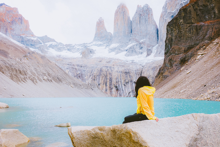
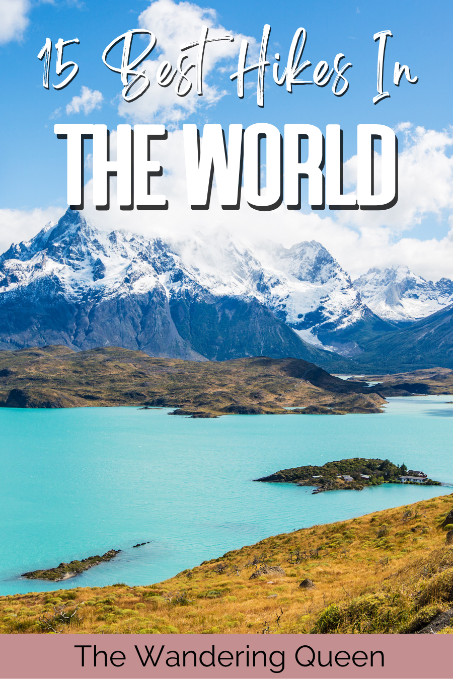
This famous trek in Patagonia has quite an interesting name. It gets its name because it looks like the letter W when you see it from above. It’s also among the least strenuous trails. It offers many opportunities for relaxation, as well as dramatic views of the park and unique wildlife.
The W Trek is a there-and-back trail. As with hiking any trail, there are wildlife safety tips you must follow.
You’ll love the jagged mountain peaks and vast landscape. No matter where you find yourself on the trail, you’ll get to see these wonderful views. Why not take photos of your hike while making stops along the way?
When night falls, you’ll want a place to rest your head. Sleeping in a refugio is required if you choose to traverse the W Trek. It’s a youth hostel on the trail with dorm rooms that accommodate up to six hikers. It also provides places to eat and shower, as well as other basic necessities someone in the great outdoors could need.
Everest Base Camp
- Location: Khumbu 44600, Nepal
- Distance: 64 miles (130 km)
- Elevation: 18,375 ft (5,364 m)
- Time: Approximately 11 and 14 days
- Best Time To Go: Late September to February-May
- Trail Guide: Link
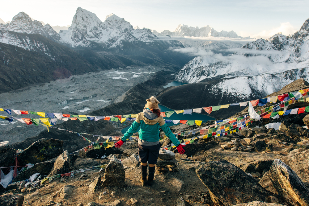
Situated at the base of arguably one of the best mountain ranges in the world, you’ll get to view the Earth’s highest mountain peak.
The long trail, half of which is vertical, has significant elevation changes and passes through rivers and thick forests. This makes it perfect for expert hikers who love cool hiking trails.
When you’re up here, the air feels thin, and doing anything – including placing one foot in front of the other – feels twice as hard. However, the trek is worth it. You’ll enjoy the sense of achievement and knowing that you’ve pushed yourself to brave what’s known as one of the world’s most strenuous trails.
It’s important to note that the Everest Base Camp is dangerous, so bear in mind that it’s not for the novice hiker. Plus, you’ll need to bring a satellite phone with you during your there-and-back hike.
Besides hiking, you’ll also be able to meet the local Sherpa people and pay a visit to the Tengboche and Thami monasteries.
Appalachian Trail
- Location: Appalachian Mountains, United States
- Distance: 2,200 miles (3,540 km)
- Elevation: 6,625 ft (2,019 m)
- Time: Approximately 5 to 7 months.
- Best Time To Go: Spring (mid-March through early April)
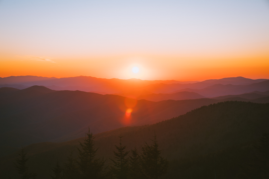
Often referred to in the Wrong Turn movie installments as being home to cannibalistic murderers, the Appalachian Trails are far from what one who’s clued into pop culture would think. Not only are the Appalachian Mountains among the best mountains to hike, but it’s also one of the best through hikes in the world.
The scenic Appalachian Trails are noted as one of the world’s longest trails. It crosses 14 state lines, two national parks, and eight national forests. The hike is equally arduous and wondrous, with clear, still lakes and rugged terrain. Without exaggeration, the Appalachian Trails are among the best places to hike in the world.
For most thru-hikers, hiking the there-and-back Appalachian Trails begins at Springer Mountain in Georgia and ends at Mount Katahdin in Maine. You don’t have to follow this. Instead, you can choose to go southbound and end in Georgia.
Tour du Mont Blanc
- Location: France, Italy, Switzerland
- Distance: 102 miles (165 km)
- Elevation: 34,212 ft
- Time: Approximately 6 and 12 days
- Best Time To Go: Summer (June through mid-September)
- Trail Guide: Link
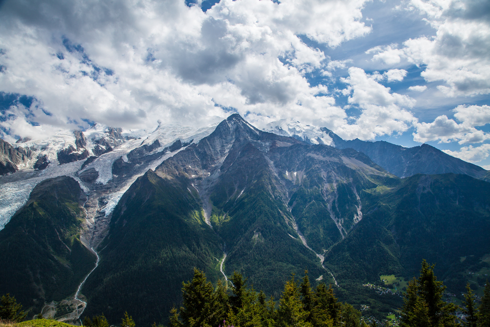
The Tour du Mont Blanc is one of the world’s luxurious hikes. It’s Western Europe’s tallest peak and is among the continent’s most popular long-distance trails. The Tour du Mont Blanc passes through Italy, Switzerland, and France while it goes around Mont Blanc Mountain.
The views along the loop hiking trail are spectacular as you traverse around the mountain range. There are various starting places, alternative routes, and public transportation. This is perfect in the event you need to cut your hike short if something goes wrong.
In addition, you’ll have access to many accommodation offerings, unlike other hiking trails. These range from mountain huts to luxury hotels.
Hiking the Mont Blanc is a fantastic option for those seeking an endurance challenge with fresh air and time in nature. The high-altitude mountain can be quite dangerous, as unpredictable weather and tough climbs can be tricky to navigate. Alleviate this by planning ahead and keeping a satellite phone on you at all times.
Great hikes are dynamic and keep you on your toes. That’s one of the reasons the Tour du Mont Blanc is a world-renown hike.
Kilimanjaro
- Location: Eastern Rift Mountains, Kilimanjaro Region, Tanzania
- Distance: 23 miles (37km)
- Elevation: 19,341 ft (5,895 m)
- Time: Approximately 5 to 9 days
- Best Time To Go: January through early March and June through October
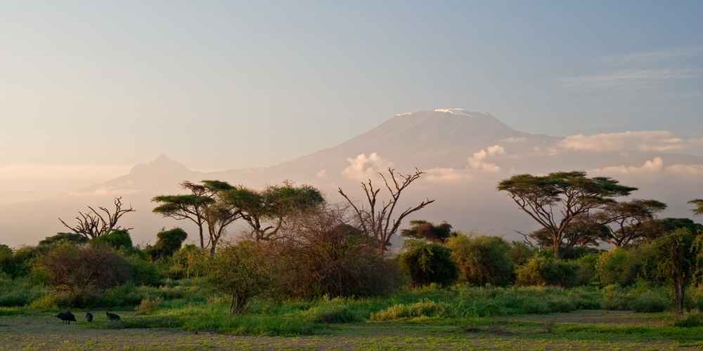
The UNESCO World Heritage Site is undoubtedly the most well-known hiking trail in the world. Check any “Top 10 Hikes in the World” list, and Mount Kilimanjaro is sure to feature.
Climbers from all around the world travel to Mount Kilimanjaro to attempt an ascent from the there-and-back trail. This enormous mountain is accessible via several trails.
If you’re thinking of where to hike, Kilimanjaro has six trails to choose from. The Marangu, Machame, Rongai, Umbwe, Lemosho, and Shira routes are among them.
One of the most popular hiking routes is the Machame trail. The Machame path is one of Kilimanjaro’s less demanding climbs, as its longer itinerary provides for better acclimatization. Many people prefer it because it offers spectacular views and a diverse range of habitats.
Another reason is that the seven-day program starts on the southwest side of the mountain and circles back to the southeast, allowing you to sleep at the same altitude for three nights in a row, which greatly assists altitude acclimatization. On the Machame route, Mount Kilimanjaro is approached from the south before being summited from Barafu.
However, it’s important to note that the risk of altitude sickness is significant, no matter the route you take. As with other hikes, you’ll need the right gear and clothing.
Grab Your Free Car Camping Checklist! 🚗🌲
Ready to elevate your car camping game? Snag our essential checklist to ensure you’ve got everything you need for a stress-free, fun-filled adventure! Perfect for beginners and seasoned campers alike. Download now and hit the road prepared! 🌟🎒
Inca Trail
- Location: Inca Trail, Peru
- Distance: 26 miles (42 km)
- Elevation: 13,776 ft (4,200 m)
- Time: Approximately 4 days
- Best Time To Go: May through September
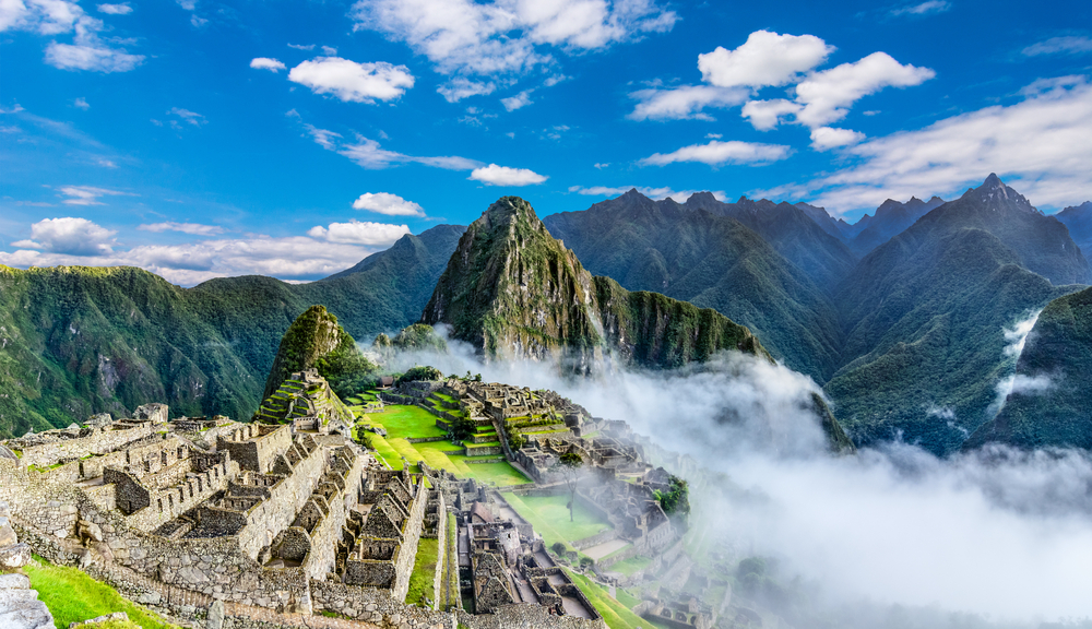
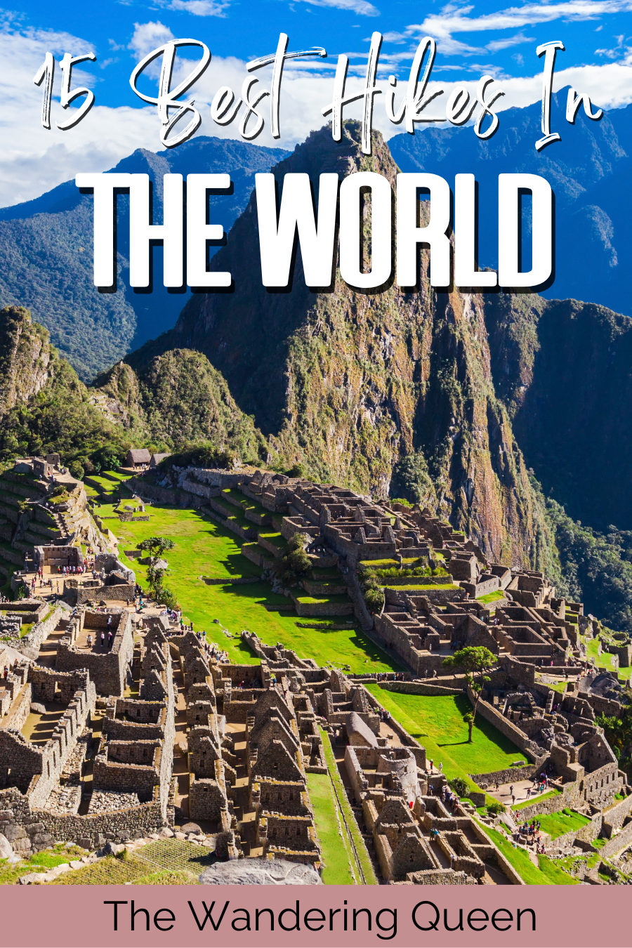
The Inca Trail begins at Lares and travels through the Urubamba mountain range. One of the hike’s great thrills is descending from the Inca Trail into Machu Picchu at sunrise.
The loop-trek Inca Trail is an opportunity to walk in the footsteps of a great vanished civilization and marvel at the ruins of “The Lost City of the Incas.” It runs from the old capital of Cusco through the Sacred Valley to the ruins of Ollantaytambo and up to the Sun Gate overlooking majestic Machu Picchu.
Along the journey, you’ll travel through the Andes Mountains, see Inca sites, and walk through a rainforest. Some consider the Inca Trail the best hike in the world because of this: there’s just so much to experience.
Even though you’ll be hiking among the ruins of a bygone civilization, you’ll need to pack some necessary travel items. To enter Peru, you’ll need your passport as well as identification to display at the official government checkpoint.
Comfortable shoes, munchies, and water bottles, as well as a first-aid kit and any medication you may require, are all essentials required for this trail.
West Coast Trail, Canada
- Location: Vancouver Island, British Columbia, Canada
- Distance: 47 miles (75 km)
- Elevation: 755 ft (230 m)
- Time: Approximately 6 and 8 days
- Best Time To Go: Summer (July through August)
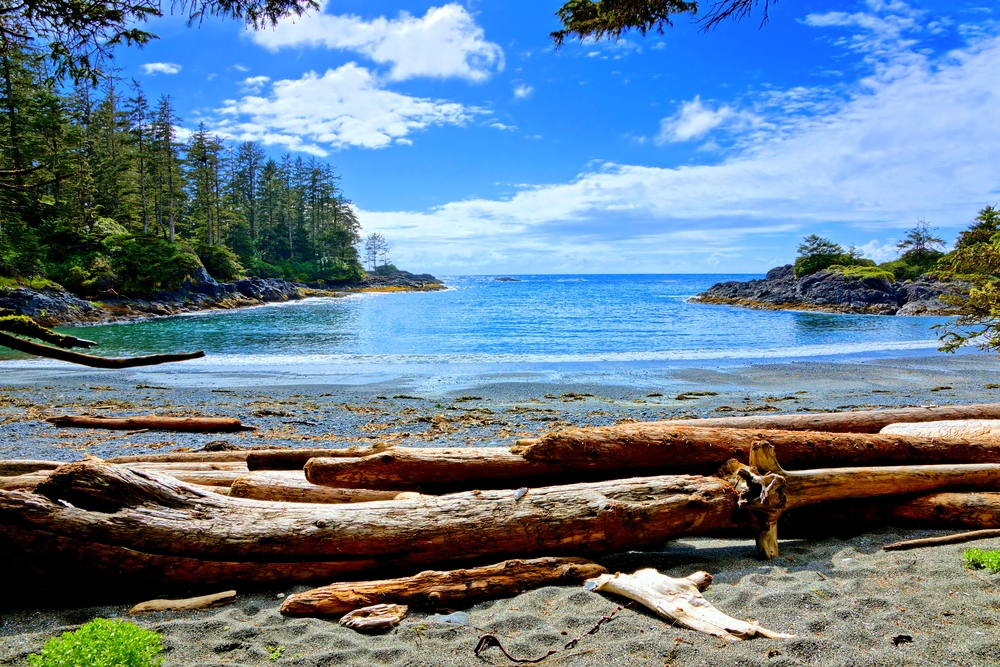
The West Coast Trail, which runs along Vancouver Island’s untamed Pacific Coast, is one of Canada’s most stunning marine excursions.
Hiking across miles of expansive white sand beaches divided by gorgeous indigenous woodland makes up a big section of the trail. It’s a fantastic chance to see the roaring surf and tide pools of a unique coastal landscape. Also worth seeing are the rock formations, old-growth forests, birds, and fauna.
You must be comfortable while hiking and use quality, lightweight equipment to enjoy this there-and-back West Coast Trail hiking adventure. Bring rain gear and warm clothing, as well as a first-aid kit with blister and bug sting medicines.
Download my free Outdoor Photography Guide
Paine Circuit Trek
- Location: Torres del Paine National Park, Magallanes and Chilean Antarctica, Chile
- Distance: 76 miles (122 km)
- Elevation: 13,290 ft (4,051 m)
- Time: Approximately 6 to 11 days
- Best Time To Go: December through March
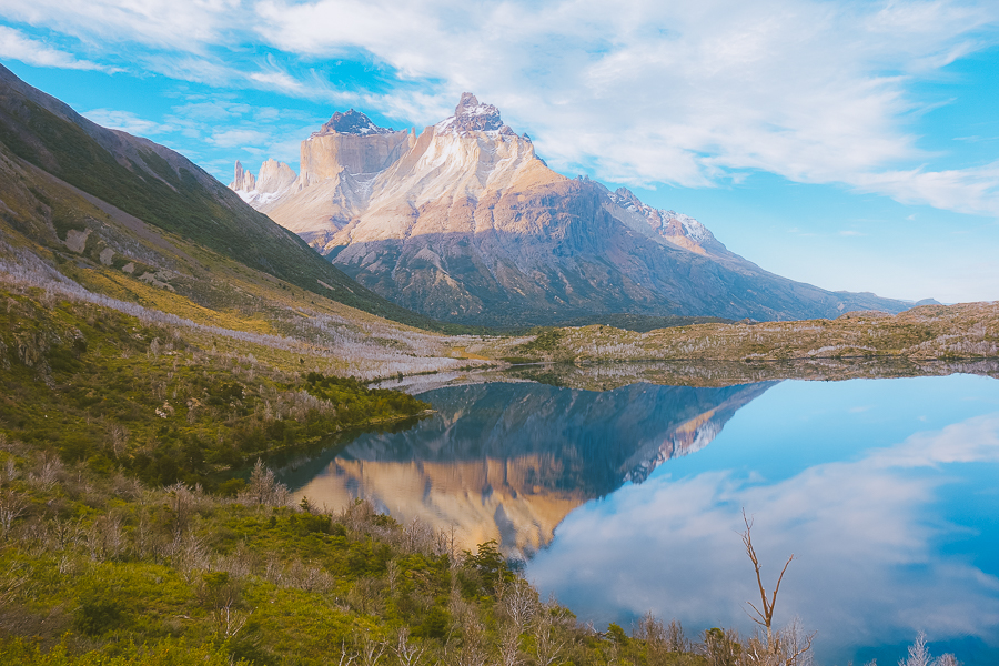
Like the W Trek, you’ll find the Paine Circuit Trek situated in the lush Torres del Paine National Park. The Paine Circuit, often known as the O Circuit, is a full loop that circles the park.
For most hikers, Torres del Paine in Chile is the best thing to do in Patagonia. The ice field, horn and tower-like rock formations, and the ever-changing environment make this an unpredictable trek.
The added distance and lack of refugios on the northern side make it a more difficult hike than the W Trek.
Plus, the O Circuit’s trails (stretches) all have a set closing time. You will not be allowed to continue walking if you arrive at a checkpoint after the given cut-off time. This is to avoid overcrowding on the trails, so it’s best to arrive and begin the hike early.
Three Capes Track
- Location: 6955 Arthur Highway, Port Arthur TAS 7182, Australia
- Distance: 30 miles (48 km)
- Elevation: 1,588 ft (484 m)
- Time: Approximately 4 days
- Best Time To Go: Summer (December through February)
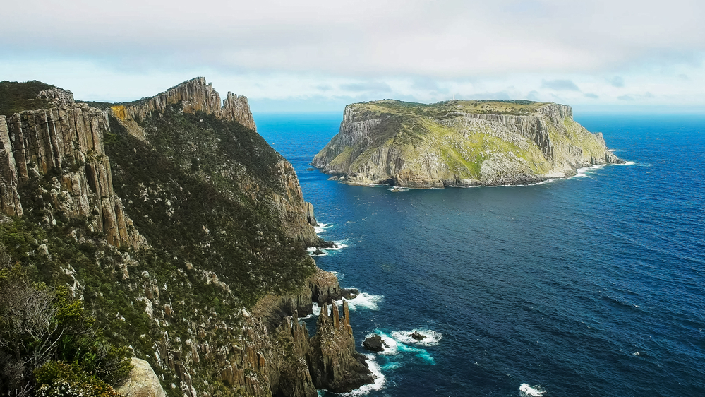
One of Australia’s most magnificent multi-day hiking treks is the Three Capes Track. It’s easy to see why, as it boasts soft coves, picturesque heathlands, lush woodlands, and, of course, some of the country’s most spectacular coastal vistas.
The trail is ideal for backpacking, camping, and trekking, but you may still find respite during the quieter hours of the day.
This one-way trip follows the tallest sea cliffs in the southern hemisphere, with breathtaking views of Cape Pillar, Cape Hauy, and Cape Raoul, in the Tasman National Park on Tasmania’s southeast coast.
The trail is available all year and is a lovely place to come at any time. Unfortunately, dogs are not permitted on this trail.
Best Day Hikes in the World
The best day walks give you a great workout, provide stunning views, and allow you to return to your day-to-day life without much readjusting. Here are the top hiking trails you can complete in a day.
Robberg Peninsula
- Location: Robberg Nature Reserve, Plettenberg Bay, Garden Route, South Africa
- Distance: 5.4 miles (8.7 km)
- Elevation: 262 ft (80 m)
- Time: Approximately 2 hours 30 minutes
- Best Time To Go: Summer (December through February)
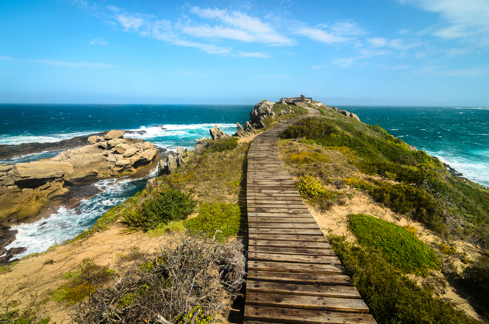
The picturesque Robberg Peninsula is located in the popular Plettenberg Bay, which is known for its soft sandy beaches and diverse wildlife. It is no wonder the area is also a premier holiday destination.
Robberg Nature Reserve boasts gorgeous craggy cliffs alongside amazing views of the Atlantic Ocean. Its scenic hiking routes feature three circulars. These are the Gap Circuit, Witsand Circuit, and Point Circuit.
Gap Circuit is the shortest of all three, whereas Point Circuit is the longest and most strenuous.
While making your way along the Gap Circuit, you’ll be led into a mudstone gap that contains evidence of Gondwanaland’s prehistoric breakup from some 120 million years ago. The 1.3-mile circuit takes half an hour to complete.
Moving up a bit further is the Witsand Circuit. Before proceeding down to the tombolo and boardwalk, the trail heads along the peninsula’s northern crest. You’ll find yourself in the shadow of the climbing falling dune.
Greet the resident seal colony as you pass above them along the trail. Once you’ve reached the end of the Witsand Circuit, you’ll come across a kelp gull colony. The route will take you two hours to complete a distance of 5.5 miles.
Irrespective of the route you take, it’s recommended that you do not stand near cliffs during heavy winds.
Cinque Terre Hike
- Location: Province of La Spezia, Italy
- Distance: 6.8 miles (11 km)
- Elevation: 1,640 ft (500 m)
- Time: Approximately 5 hours
- Best Time To Go: Spring (March through June) and autumn (September through October)
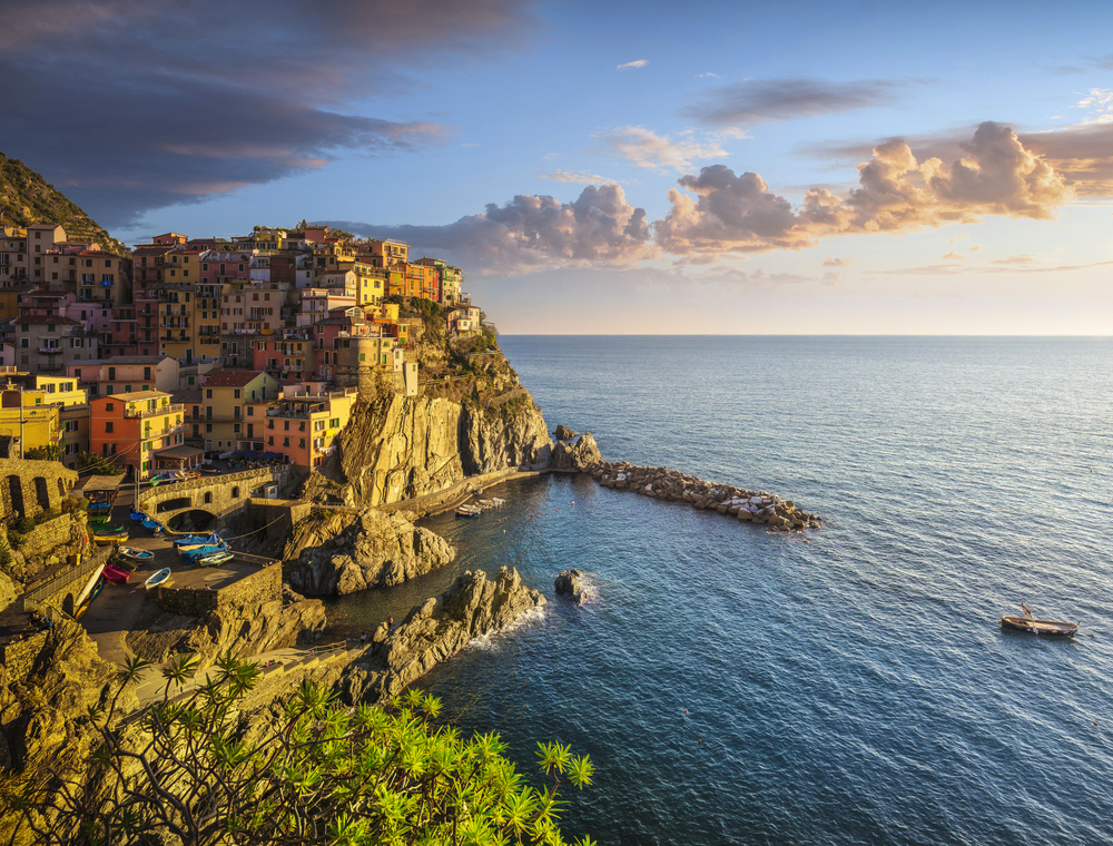
One of the nicest things to do in Italy is going hiking in the Cinque Terre. It has some of Europe’s most stunning hiking paths.
Between Riomaggiore, Manarola, Corniglia, Vernazza, and Monterosso al Mare, you have five treks to choose from.
You can decide whether you wish to hike through all of Cinque Terre’s towns or just a few. You can hike all day or just trek for several hours. If you’re a beginner, it’s recommended that you hike for just a few hours.
Hiking Cinque Terre is one of the most rewarding ways to enjoy Italy’s stunning coastline. Thanks to the there-and-back trails’ proximity to restaurants and bars, you don’t have to forego comforts like delicious food and wine.
Puez-Odle Altopiano
- Location: Parco Naturale Puez Odle, Autonomous Province of Bolzano – South Tyrol, Italy
- Distance: 9 miles (14.5 km)
- Elevation: 1,640 ft (500 m)
- Time: Approximately 6 hours
- Best Time To Go: Italian summer (June through September)
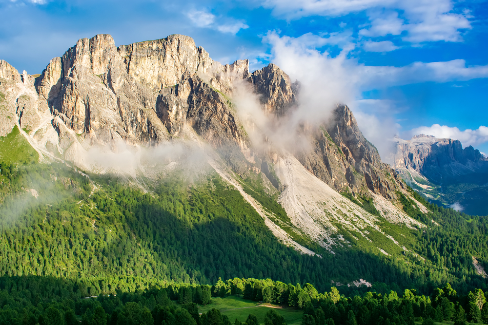
The Puez-Odle Altopiano is situated high in the Italian Dolomite range and can be reached via the capable Dantercepies cable car. Hiking to the range can be considered among great treks that test your stamina and willpower.
Once you’ve reached the top, you’ll notice that you’ve left the lush green scenery and are now in rocky territory (literally). This doesn’t take away from the epic views you’ll enjoy on the trail.
The loop hike on Puez-Odle Altopiano stretches for a distance of around nine miles, making it perfect for both beginners and experts. Newbie hikers will appreciate the comforts of civilization, such as restaurants to grab a bite to eat and refugios to lay one’s head down.
Aconcagua Base Camp, Argentina
- Location: Mount Aconcagua, Mendoza, Argentina
- Distance: 9 miles (14.5 km)
- Elevation: 22,841 ft (6,962 m)
- Time: Approximately 6 hours
- Best Time To Go: November through March
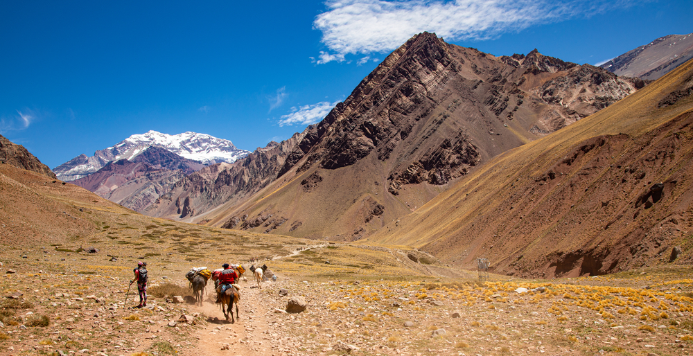
Enjoy spectacular views of Mount Aconcagua’s south face as well as the rare opportunity to observe expeditions departing.
Aconcagua can be reached by a variety of methods, but the 360-degree path provides an unparalleled experience.
Hike among glaciers surrounded by beautiful mountains to see Aconcagua’s breathtaking faces. You’ll be able to walk around the entire mountain. It does not return you to the same trail where you started, making for an unpredictable hike.
Bring a backpack with you for the acclimatization hike and the walk into base camp.
The Enchantments
- Location: Leavenworth, WA 98826, United States
- Distance: 5 miles (8 km)
- Elevation: 4,500 ft (1,372 m)
- Time: Approximately 8 to 15 hours.
- Best Time To Go: Mid to late summer (July through October)
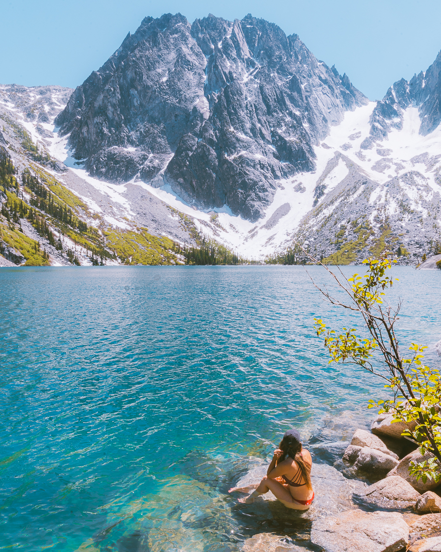
The name of this Disney-like trail in the Alpine Lakes is not for show. Once you’ve traversed this trail, it will be evident that it’s one of the most beautiful hikes in the world.
Smooth granite and crystal clear lakes are featured prominently in this Alpine paradise. The breathtakingly beautiful landscape has been swamped by the wind and cold. It’s quite impressive, given how picturesque the location is.
Unfortunately, your dog won’t be able to experience one of the most beautiful hiking trails in the world. Pet owners are required to leave their dogs at home as they aren’t allowed on the point-to-point hike.
Hikers are also prohibited from starting campfires in the Enchantments. This helps prevent both forest fires and the scavenging of deadwood.
Panorama Ridge
- Location: Whistler, British Columbia V0N 1H0, Canada
- Distance: 19 miles (30 km)
- Elevation: 6,998 ft (2,133 m)
- Time: Approximately 10 hours
- Best Time To Go: July through October
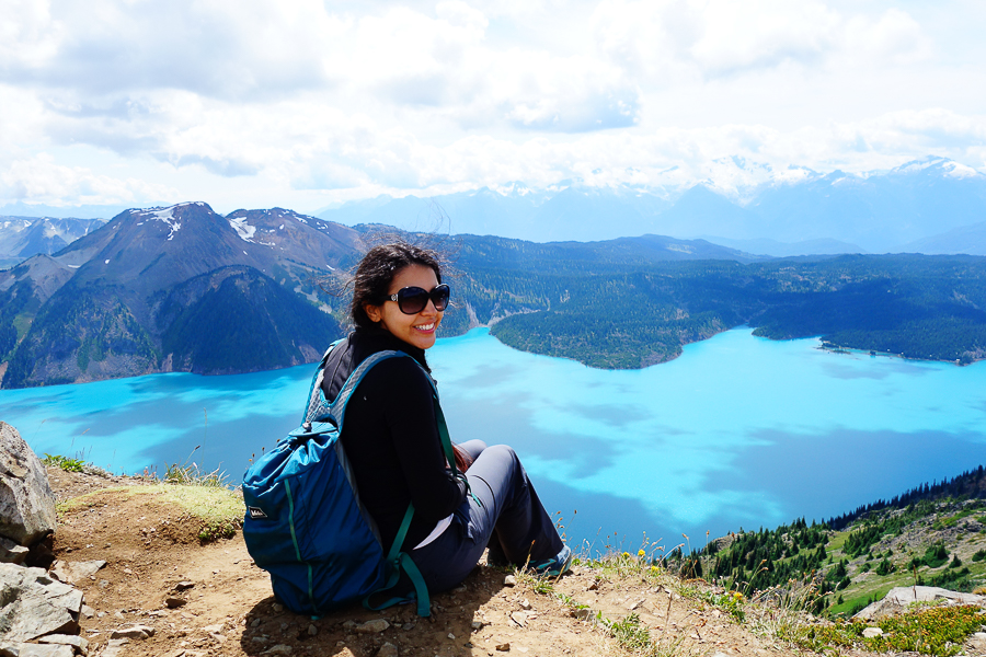
Panorama Ridge provides some of the finest beautiful vistas in the Garibaldi Provincial Park area. Between the villages of Squamish and Whistler is this loop trail.
Panorama Ridge is a popular trekking and bird-watching destination. You can also go camping in the area, making this a versatile trail.
Your walk will lead you up from Rubble Creek through a forest of Western Red Cedar and Douglas Fir trees, through meadows full of blooming wildflowers, and to the summit. Here you’ll be treated to one of the most breathtaking panoramic views you’ll ever see.
While Panorama Ridge is a good place to hike for adults, the same can’t be said for dogs. In light of this, dogs aren’t permitted on this trail. You’ll have to leave your fur babies at home.
Fimmvorduhals Hike, Iceland
- Location: Between Eyjafjallajokull and Myrdalsjokull Glaciers, Southwest Iceland
- Distance: 16 miles (25 km)
- Elevation: 3,504 ft (1,068 m)
- Time: Approximately 12 to 14 hours
- Best Time To Go: Mid-June to September
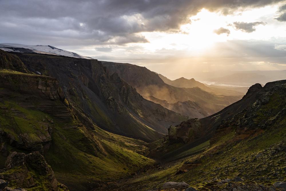
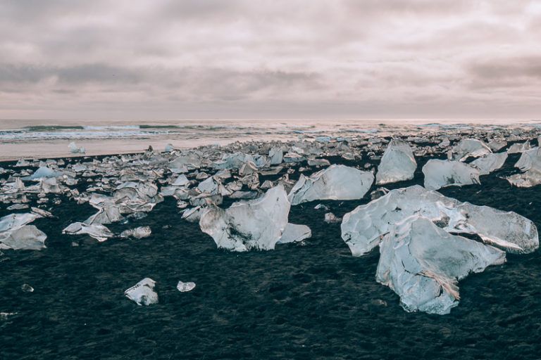
Fimmvorduhals is one of Iceland’s most incredible hiking trails. And it can be argued that it offers some of the best hiking in the world, especially when you look at its routes.
The there-and-back Fimmvorduhals route leads through some of Iceland’s most breathtaking scenery. Your trek will begin in South Iceland near Skogafoss and conclude in Thorsmork, passing between the Eyjafjallajokull and Myrdalsjokull glaciers. Alternatively, you can complete the trail from Thorsmork to Skogafoss without sticking to this direction.
If you aren’t spending much time in Iceland, the Fimmvorduhals route is a good alternative for a day hike. This strikingly beautiful trail is one of the best hikes around the world.
Because there are no stores along the route where you can buy food or drink, you’ll need to stock up ahead of time. Pack enough snacks and drinks to sustain you over the course of this 16-mile hike. If you run out of water, you can always refill your bottle at the pristine Skoga river.
The Zion Narrows, Zion National Park
- Location: Zion Canyon, Zion National Park, Utah, United States
- Distance: 16 miles (26 km)
- Elevation: 4,577 ft (1,395 m)
- Time: Approximately 10 to 13 hours
- Best Time To Go: Summer
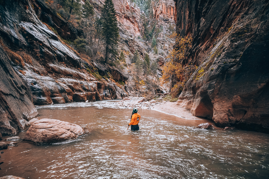
One of the most well-known hikes in the world is the Zion Narrows. It’s also one of the most distinctive pathways in Zion National Park.
If you’ve ever wondered where it received its name, you can stop wondering now. The trail is named after its narrowest portion on Wall Street, which has been eroded by rivers for 18 million years, cutting 1500-foot walls into the earth.
You should be aware that the there-and-back trail can be dangerous. While hiking through slot canyons and rivers, flash flooding can occur. Avoid this by consulting the ranger manager for rain predictions and advice.
Given the dangerous nature of this trail, it’s recommended that you bring a Stateline phone to stay connected no matter how far you go.
Kings Canyon Rim Walk
- Location: Kings Canyon Access, Petermann NT 0872, Australia
- Distance: 4 miles (6 km)
- Elevation: 0.4 mi (0.6 km)
- Time: Approximately 3 to 4 hours
- Best Time To Go: May through September
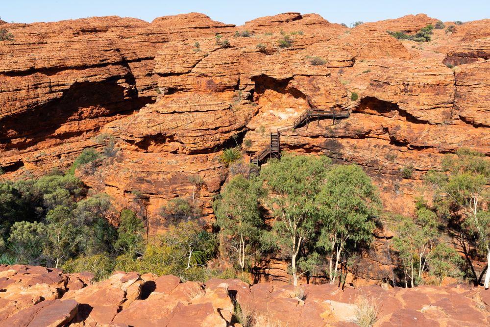
Watarrka National Park protects an elevated sandstone mountain with vegetation-rich clefts, the most famous of which is Kings Canyon.
The mesmerizing Rim Walk is a classic climb to the top of Kings Canyon, which allows visitors to have a bird’s eye view of the desert terrain.
The rock coloration and formations on this loop walk, like much of the neighboring parks, are stunning. And as a bark aficionado, you can get up close and personal with some fairly amazing ghost gums and other occasional trees.
The Kings Canyon Rim Walk is one of the greatest hikes in the world, in no small part due to its beautiful sandstone domes and rocky terrain.
Grand Canyon Rim-to-Rim
- Location: South Rim, Grand Canyon National Park, Arizona, United States
- Distance: 24 miles (39 km)
- Elevation: 8,297 ft (2,592 m)
- Time: Approximately 12 to 15 hours
- Best Time To Go: May through October
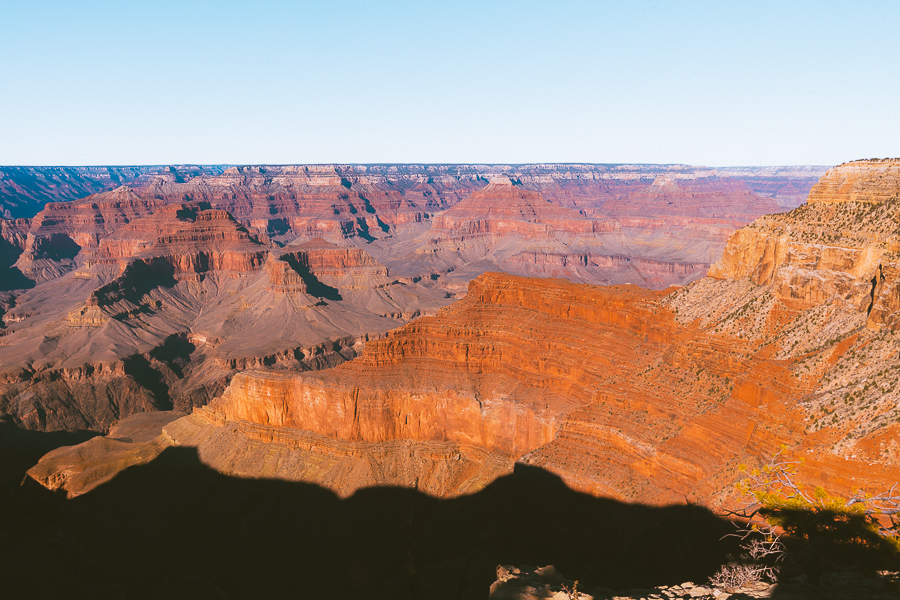
According to the National Park Service, around five million people visit the Grand Canyon National Park every year. It’s no wonder why: the Grand Canyon is an outstanding work of nature.
If you are among such staggering numbers of visitors and looking for things to do in Grand Canyon National Park, then hiking the Grand Canyon Rim-to-Rim could be a perfect fit for your ever-growing hiking bucket list.
Hiking on a “rim-to-rim” hike involves going from the south to the north rim or the north to the south rim.
Why not look up the best Grand Canyon views? This way, you’ll get all the help you need to enjoy spectacular views and capture some awesome shots from one of the best mountains to hike.
Half Dome
- Location: Eastern end of Yosemite Valley, Yosemite National Park, California, United States
- Distance: 17 miles (22.7 km)
- Elevation: 8,839 ft (2,694 m)
- Time: Approximately 10 to 12 hours
- Best Time To Go: Late spring/summer until mid-fall (May-June through October)
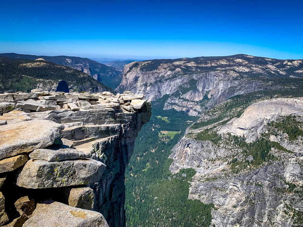
This spectacular there-and-back hiking trail in the wondrous Yosemite National Park is often overcrowded due to its popularity. But it’s worth it. You’ll enjoy 360-degree views of the surrounding mountains.
Offering one of the most epic hikes of the world, Half Dome features terrifyingly steep trails leading up to its peak. To keep hikers and climbers safe, the National Park Service advises taking your time, being patient, and staying on the inside of wires while summiting the Half Dome.
Those looking to hike Half Dome should know that hiking permits are now required and have been granted on a lottery system since March.
Only 300 hikers per day are allowed. And it’s been suggested that entering the lottery on a Tuesday or Wednesday could boost your chances of winning (you didn’t hear that here).
So, get up early on a Tuesday or Wednesday morning, and don’t miss the chance to visit one of the best hiking destinations in the world.
Tongariro Alpine Crossing
- Location: Tongariro National Park, Whakapapa Village, State Highway 48, Mount Ruapehu, New Zealand
- Distance: 12.1 miles (19.4 km)
- Elevation: 6,119 ft (1,865 m)
- Time: Approximately 6 to 8 hours
- Best Time To Go: Summer (December through February)
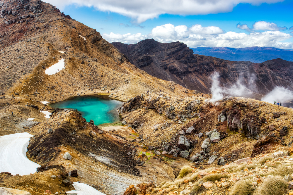
The Tongariro Alpine Crossing is recognized as New Zealand’s best one-day hike and one of the top ten single-day treks in the world. The Tongariro Alpine Crossing is a breathtaking 12-mile hike through Tongariro National Park, a UNESCO Dual World Heritage Site known for its spiritual and cultural significance, as well as its spectacular volcanic characteristics.
The magnificent trail passes through some of the most stunning scenery you’ll ever see, including cool mountain springs, ancient lava flows, steam vents, and the Emerald Lakes. Hikes on most trails don’t offer you these kinds of views.
Trek across the lovely volcanic alpine region from November to May. If you’re hiking from June to October, have a guide because the ice and snowy trail will require assistance.
The pathway can be walked in either direction you choose, but the most popular route starts in the beautiful Mangatepopo Valley.
Angels Landing
- Location: Zion National Park, Washington County, Utah
- Distance: 2.4 miles (3.9 km)
- Elevation: 5,791 ft (1,765 m)
- Time: Approximately 3 to 6 hours
- Best Time To Go: Early morning or late afternoon
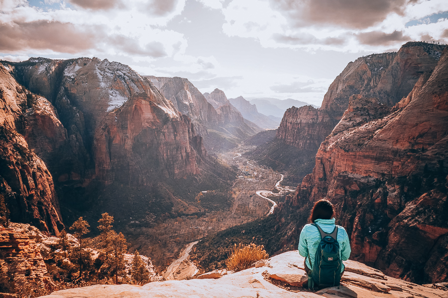
It’s often been said that this is a round-trip trail for only the bravest hikers. Not only will you be tested physically as you navigate narrow sections and dizzying heights, but you’ll have to maintain the right mindset needed to complete this trail.
You would think that the strenuous hike would be unpopular, right? On the contrary, it is estimated that more than 300 000 hikers have traversed the trail.
What draws daredevil crowds to the trail are the enchanting views, emerald pools, and the feeling of the (natural) world at your feet. It’s no surprise that Angel’s Landing is one of the best hiking places in the world.
Kjeragbolten
- Location: Kjerag, Sandness, Rogaland County, Norway
- Distance: 7.5 miles (12 km)
- Elevation: 3,642 ft (1,110 m)
- Time: Approximately 6 to 8 hours
- Best Time To Go: Summer months (June through August)
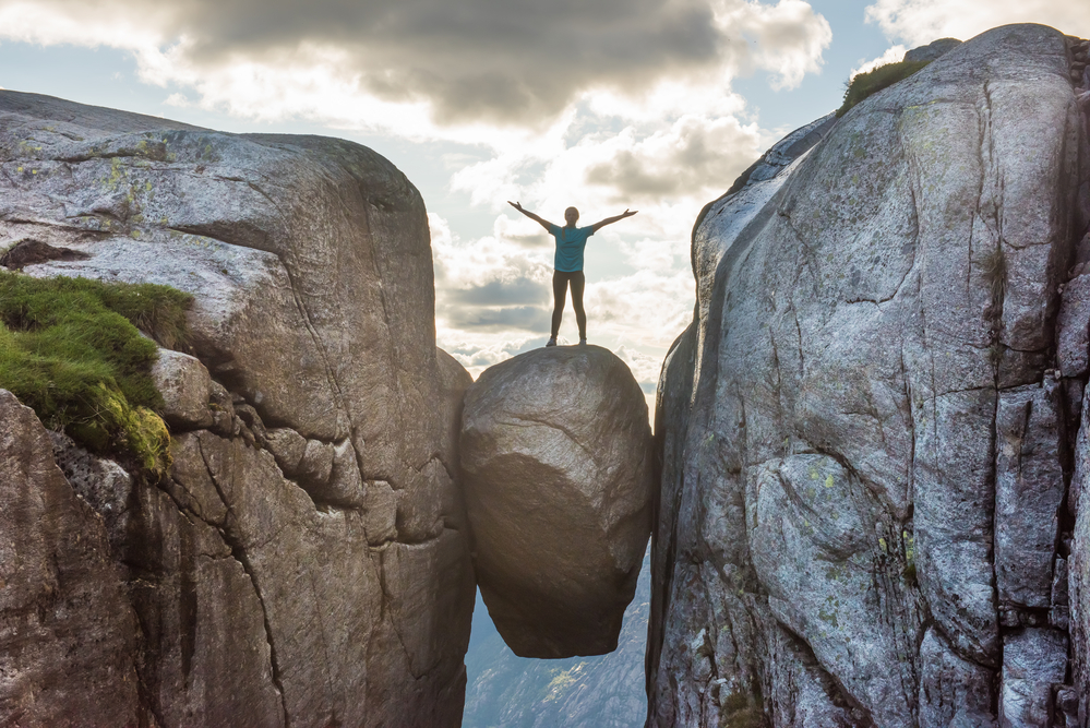
Wedged between two mountains is the Kjeragbolten: The iconic 3,281 ft boulder that beckons adventure-seeking hikers to step on it.
Kjerag Mountain is found in icy Norway. Traversing it requires you to use wires to help you reach certain points. This is evidence of it being demanding for experienced hikers too. Despite this, it’s one of the top hikes in the world.
If you’re an inexperienced hiker, you’ll be pleased to know that guided hikes are available for this there-and-back trail. An interesting fact about the Kjerag is that it has been certified as a Norwegian Scenic Hike by the Norwegian Environmental Agency.
Bright Angel Trail
- Location: Grand Canyon Village, Arizona, United States
- Distance: 8 miles (13 km)
- Elevation: 6,860 feet (2,091 m)
- Time: Approximately 5 to 6 hours
- Best Time To Go: October through May
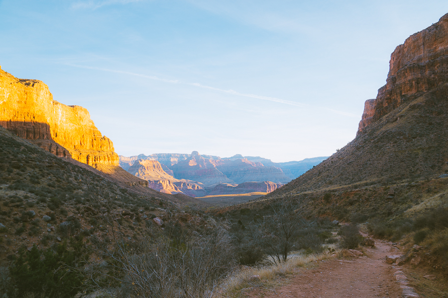
The strenuous Bright Angel Trail, which features several stories, is located in the Grand Canyon National Park.
The Havasupai people were the first to use the Bright Angel Trail thousands of years ago. Ralph Henry Cameron gave it its current name in 1901 and the trail was added to the National Park in 1928. It is now the most popular there-and-back hike below the rim of the Grand Canyon.
Like Angel’s Landing, the Bright Angel Trail can be quite arduous. Despite its impressive rock formation and beautiful landscapes, it’s important to observe certain rules to have a safe hike.
Firstly, allow uphill hikers to pass first as you’re walking down. It’s worth making the effort to travel to the south rim of the Canyons to bask in breathtaking views. Most hikers only see the canyon from above the rim, but seeing it from below offers you spectacular views, too.
You’ll need comfortable shoes while enduring this serious hike. It can get quite hot out there, ensure you wear a cap and drink plenty of water.
Final Thoughts on Best Hiking Trails in the World
This ultimate list of the best day hikes in the world will help you find the best hiking trail for your adventure needs. Whatever trail you’re considering, hiking is a thrilling way to experience skylines, waterfalls, and other natural wonders.
The world’s best hikes will push you to your limits and
These amazing trails remind you that you don’t necessarily have to go far in search of breathtaking places. Learn about the seven principles of “No Trace,” so you can leave the trails in great condition after your next hike.

Claim your FREE Hiking Checklist
Ready to start hiking? Grab my free hiking checklist and never forget anything at home!


