The 6 Best Hikes In Red Rock Canyon Las Vegas
When I decided to visit Red Rock Canyon National Conservation Area, I didn’t know much about it. I finally researched and picked a few trails I wanted to do, but I didn’t expect much from this park because I had never heard of it before. Boy, was I surprised at how wonderful this park is! There are so many trails, and the views are phenomenal. I was blown away! What surprised me, even more, was how close it was to Las Vegas! I can’t believe it took me this long to visit Red Rock Canyon, and now I want to go back and see even more. So below, I list the best hikes in Red Rock Canyon and even give some tips on how to get there, what to pack, and much more.
Disclosure: This post contains affiliate links. If you click one of them, I may receive a small commission (for which I am very grateful for) at no extra cost to you.
Entrance Information On Red Rock Canyon
Timed reservations are required for vehicle entry to the Scenic Loop between 8 am-5 pm from October 1 through May 31. You have to make a reservation online before entry. You can make the reservation here.
If you have the America The Beautiful Pass, you can enter for free. Just enter the number when you checkout.
During the off-season, you don’t need to make a reservation. Just pay at the entrance. The fee is $15 per vehicle.
Download my free Outdoor Photography Guide
Best Time To Go To Red Rock Canyon
The best time to go to Red Rock Canyon is November through March. Temperatures are pretty mild for hiking (60 degrees F to 75 degrees F), during the day. Keep in mind that Vegas summers can be hot, and winter temps can be surprisingly cold. So it is best to avoid Red Rock Canyon in the summer.
If you go in the summer, think about going early in the morning to avoid the unbearable heat.
Red Rock Canyon Hiking Tours
Below are many options for a guided hiking tour. All the tours pick you up from Las Vegas.
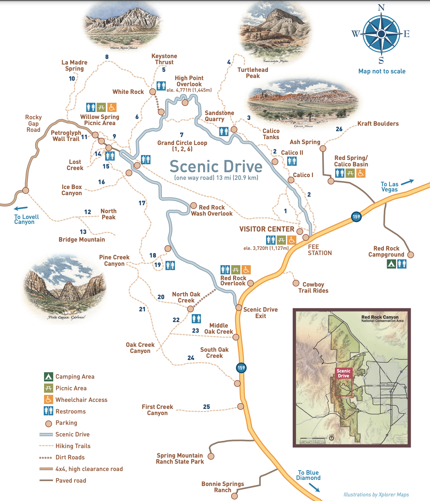
Map Of Best Hikes In Red Rock Canyon
I have all the trailheads flagged on the map below. There is also an official Red Rock Canyon Map Here.
FAQ On Best Hikes In Red Rock Canyon
- With more than 2,000 climbing routes, Red Rock Canyon National Conservation Area is one of the top five climbing destinations in the United States.
- Bring a lot of water. It gets hot even in the winter!
- Hike with a buddy.
- Beware of flash floods. Always check the weather before heading out.
- Lightning storms frequently occur in the afternoon during the summer months. Avoid going on top of rocks during a lightning storm.
- There is not much cell service, so be prepared.
- You can camp in the park. Here is more information.
- You can fly a drone.
- Pets are allowed on trails, but they are not allowed to be left inside vehicles. It can be very dangerous with the hot temperatures.
- Bring plenty of sunscreen.
How To Get To Red Rock Canyon
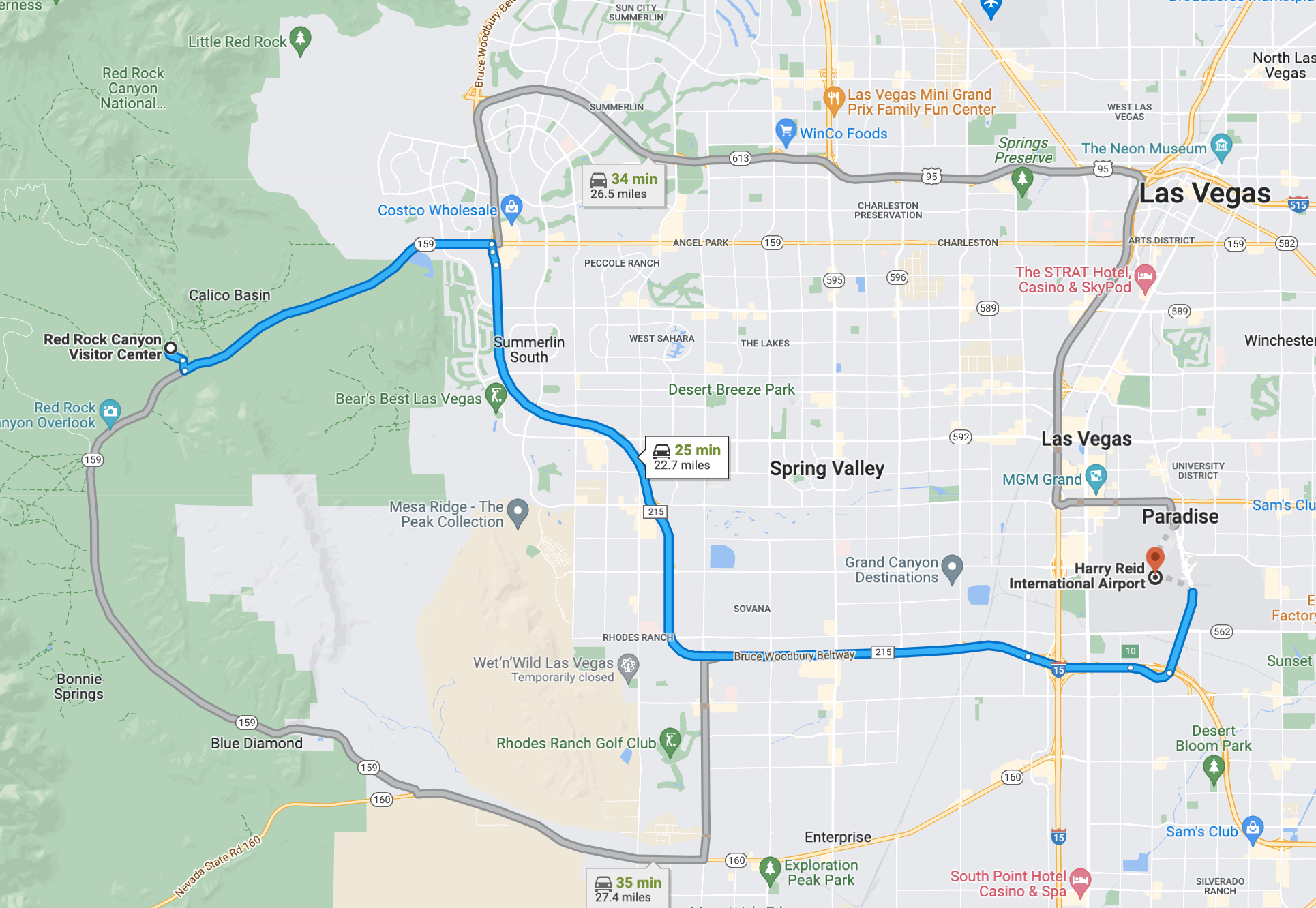
- The Red Rock Canyon Visitor Center is about 25 minutes away (22.7 miles) from the Harry Reid International Airport in Las Vegas, Nevada.
- It is best to rent a car from the airport and drive there early in the morning.
Hotels In Las Vegas
The best place to stay near the park is in Las Vegas, Nevada. Below is a map of the best hotels in Las Vegas.
Booking.comHow Much Time Do You Need For Hiking At Red Rock Canyon
You only need 1-2 days to see most of Red Rock Canyon. The trails are long but moderate, so I would allocate about 2-3 trails in one day. There are around 26 trails in Red Rock Canyon.
What To Pack When Hiking In Red Rock Canyon
Sunscreen: Nevada gets HOT! Even in the winter, we were hiking in bright sunny weather at times. >Buy Sunscreen
Hiking Boots/Shoes: If you use tennis shoes, you can easily hurt your toes by hitting a rock by accident (Trust me, I have done it so many times before). >Check Out My Hiking Shoes
Hiking socks: Having the correct socks helps you prevent getting blisters. Smart Wool is probably my favorite brand out there. >Buy Hiking Socks
Water Reservoir: Water reservoirs help prevent me from getting dehydrated while hiking. The great thing about this reservoir is that it doesn’t have a plastic taste. >Here Is My Water Reservoir
Water: Stay nice and hydrated.
Sunglasses: It can get sunny, so make sure to pack some sunglasses. >Check Out These Sunglasses
Snacks: The best snacks are jerky, nuts, and energy bars. Clif Bars are great for hiking.
Camera: The Sony A6000 was one of the first cameras I started traveling with. The Sony A6000 is an excellent camera for people that want to start improving at travel photography. >Buy Sony Camera Here
First Aid Kit: This is one of the first things I bought when I first started going on adventures. It is super portable. >Buy This Awesome First Aid Kit Here
Day Pack to carry all your things: The REI bag I have linked, we have had for seven years now, and it is still going strong! >Buy This Great Quality Backpack
Headlamp: A headlamp is an absolute must in case you get stranded in the dark! It is a lot more portable and easier to use than a flashlight. >Buy A Headlamp Now
Leggings or Hiking Pants: I always wear leggings while hiking because it is what I feel most comfortable with! >Click For My Favorite Hiking Leggings
Breathable sweat-wicking shirts: Cotton shirts soak up your sweat when hiking, so make sure to wear something breathable. >Check out this awesome breathable shirt here.
Sports Bra: For women. >Buy One Here
Jacket: In case you get chilly during sunrise. >Buy My Favorite Jacket
Tripod: This is an optional item, but it is excellent for getting the ideal sunset pictures. >Check out this tripod
Knife: I always carry a knife in my backpack just in case. >Check Out My Knife Here
Claim your FREE Hiking Checklist
Ready to start hiking? Grab my free hiking checklist and never forget anything at home!
Red Rock Canyon Scenic Drive
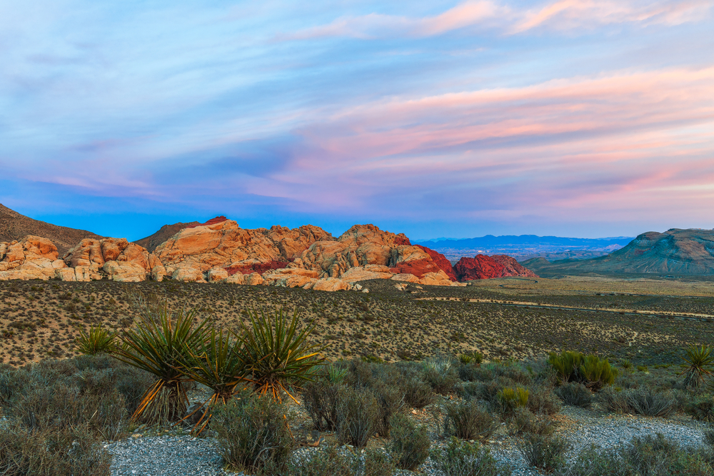
My favorite part of Red Rock Canyon was the scenic drive. The views on this drive are outstanding and deserve mention. I was a little confused at first when we were on this road, so below are some pointers so you can take advantage of this wonderful road.
- There are people biking the road, so watch out for bikers and drive slow,
- The road is one way, so make sure you know where you want to go beforehand. There is no turning around. You will have to drive the whole loop again, which can take a while.
- The loop is 13 miles. Take your time, though, because the views are breathtaking everywhere.
- You don’t have to hike to enjoy Red Rock Canyon. There are many pretty overlooks on the drive that are worth seeing, like Sandstone Quarry Overlook, High Point Overlook, Red Rock Wash Overlook, and Red Rock Canyon Overlook.
- You don’t need to get on the Scenic Drive to hike some of the trails in the park (the fee area). There are around five trails not located on the Scenic Drive (Middle Oak Creek, South Oak Creek, First Creek Canyon, Kraft Boulders, and Red Spring Boardwalk).
Best Hikes In Red Rock Canyon
Calico Tanks
- Distance: 2.4 miles, roundtrip
- Elevation Gain: 406 ft.
- Route Type: Out and Back
- Difficulty: Moderate
- Trail Guide: Link
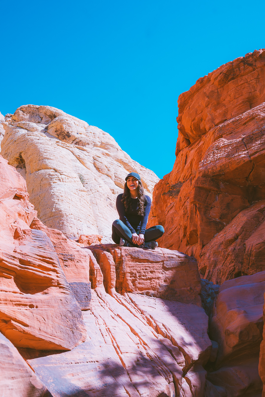
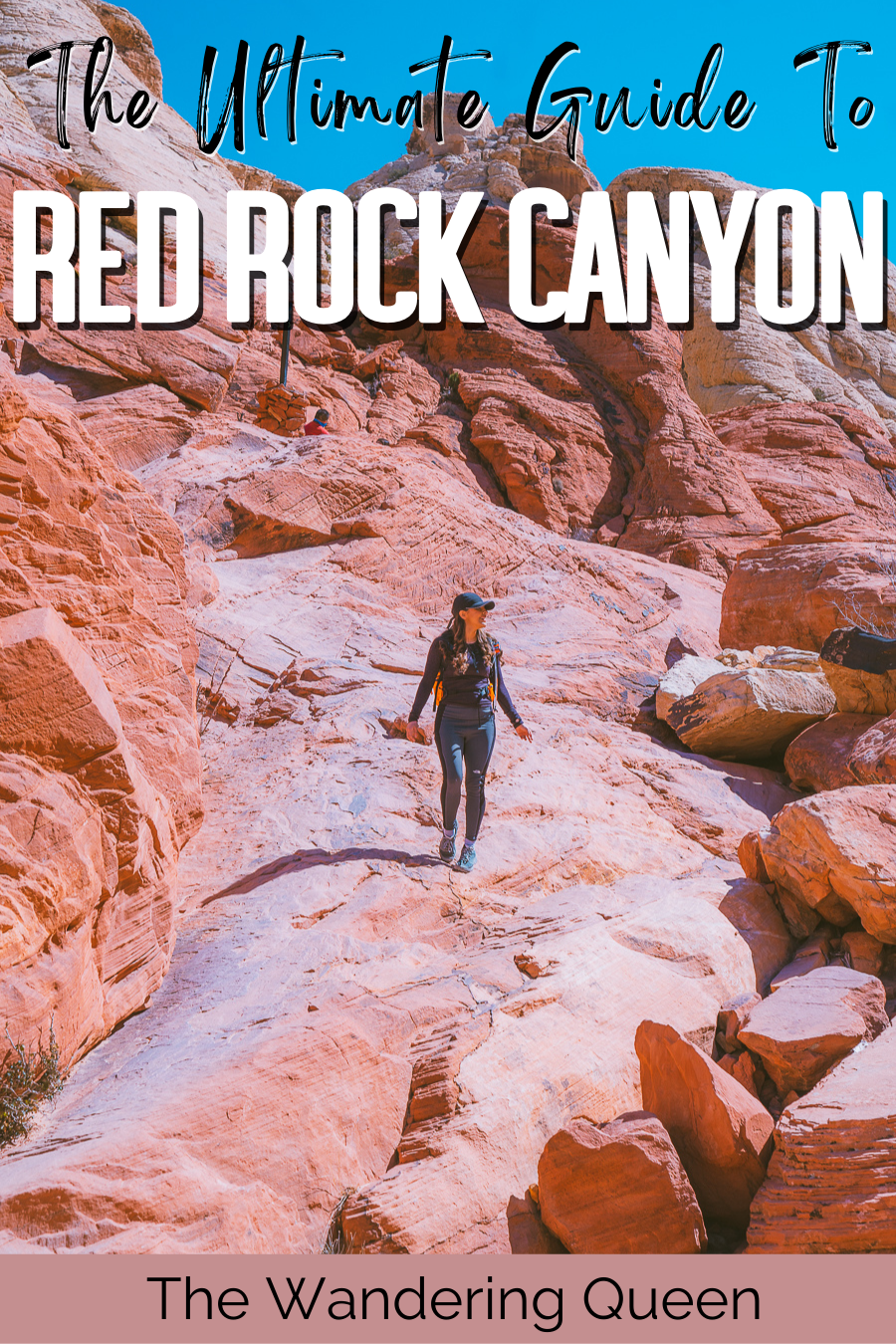
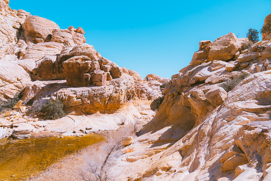
If you only have time for one hike, I recommend the Calico Tanks Trail. This hike is breathtaking and has a beautiful show of bright red and yellow rocks throughout the hike. You have to do some scrambling and climbing, but that is what makes this trail so much fun!
I saw many people of all ages on this trail. Some people took their time, and others climbed quickly. Since the views were so spectacular, we took our time and took many photos with the red rocks.
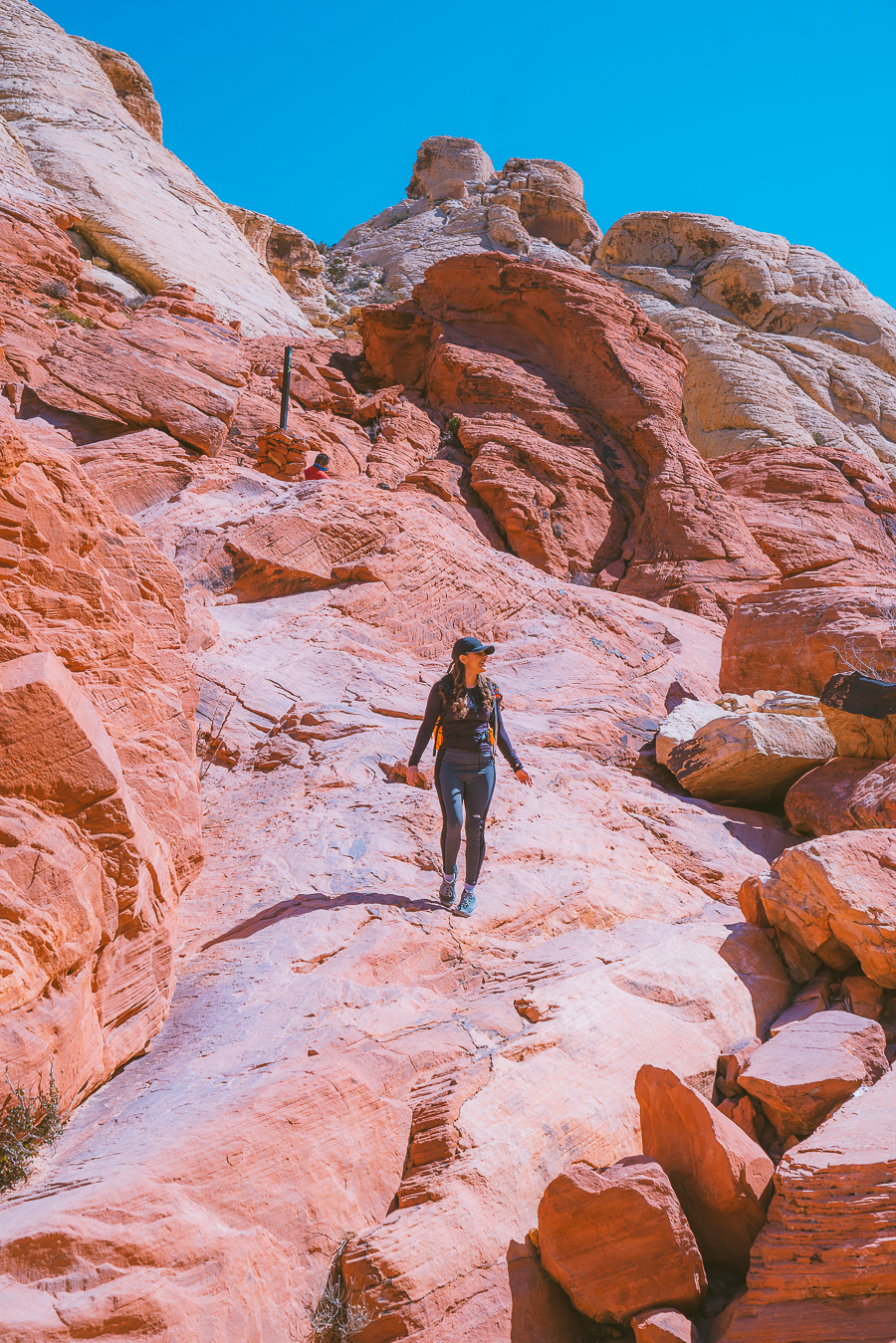
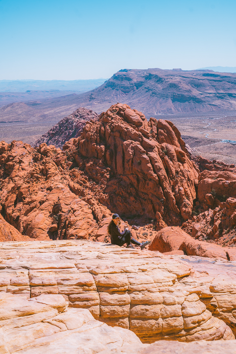
Eventually, the trail ends at the viewpoint, as seen below. A little bit of scrambling and climbing helped us get the best views of Las Vegas Valley. Right before the end view, there is a natural water tank that the trail is named after. This trail is what made me fall in love with Red Rock Canyon.
Calico Hills
- Distance: 2-6 miles, roundtrip
- Elevation Gain: 400 ft.
- Route Type: Out and Back
- Difficulty: Moderate
- Trail Guide: Link
The Calico Hills Trail is the first trailhead off of the Scenic Loop Drive, which means it is the most popular hike in the whole park. You can start at Calico I or Calico II parking lot, and if you want to make the trail longer or more difficult, you can add in the Calico Tanks at the end. This trail is one of those hikes that you can make as long or as difficult as you would like.
Grab Your Free Car Camping Checklist! 🚗🌲
Ready to elevate your car camping game? Snag our essential checklist to ensure you’ve got everything you need for a stress-free, fun-filled adventure! Perfect for beginners and seasoned campers alike. Download now and hit the road prepared! 🌟🎒
Lost Creek Canyon And Children’s Discovery Loop Trail
- Distance: 0.8 miles, roundtrip
- Elevation Gain: 98 ft.
- Route Type: Loop
- Difficulty: Easy
- Trail Guide: Link
Lost Creek Canyon features a lovely waterfall, depending on what time of year you go. It can either be a roaring waterfall or only a trickle. Either way, this is a great trail for the whole family because it is so easy, and if you go in the Spring, you might witness a beautiful array of Spring wildflowers.
Turtlehead Peak Trail
- Distance: 4.6 miles, roundtrip
- Elevation Gain: 1,988 ft.
- Route Type: Out And Back
- Difficulty: Hard
- Trail Guide: Link
If you want a challenge, you need to check out Turtlehead Peak trail, one of the more difficult trails in the park. The elevation gain here is no joke so bring plenty of water and a map. The directions for the trail are not the best, and it is easy to lose the official trail if you are not paying attention.
The views at the top are some of the best, but it can be a challenge, so this trail is for more advanced hikers.
Ice Box Canyon
- Distance: 2.3 miles, roundtrip
- Elevation Gain: 577 ft.
- Route Type: Out and Back
- Difficulty: Moderate
- Trail Guide: Link
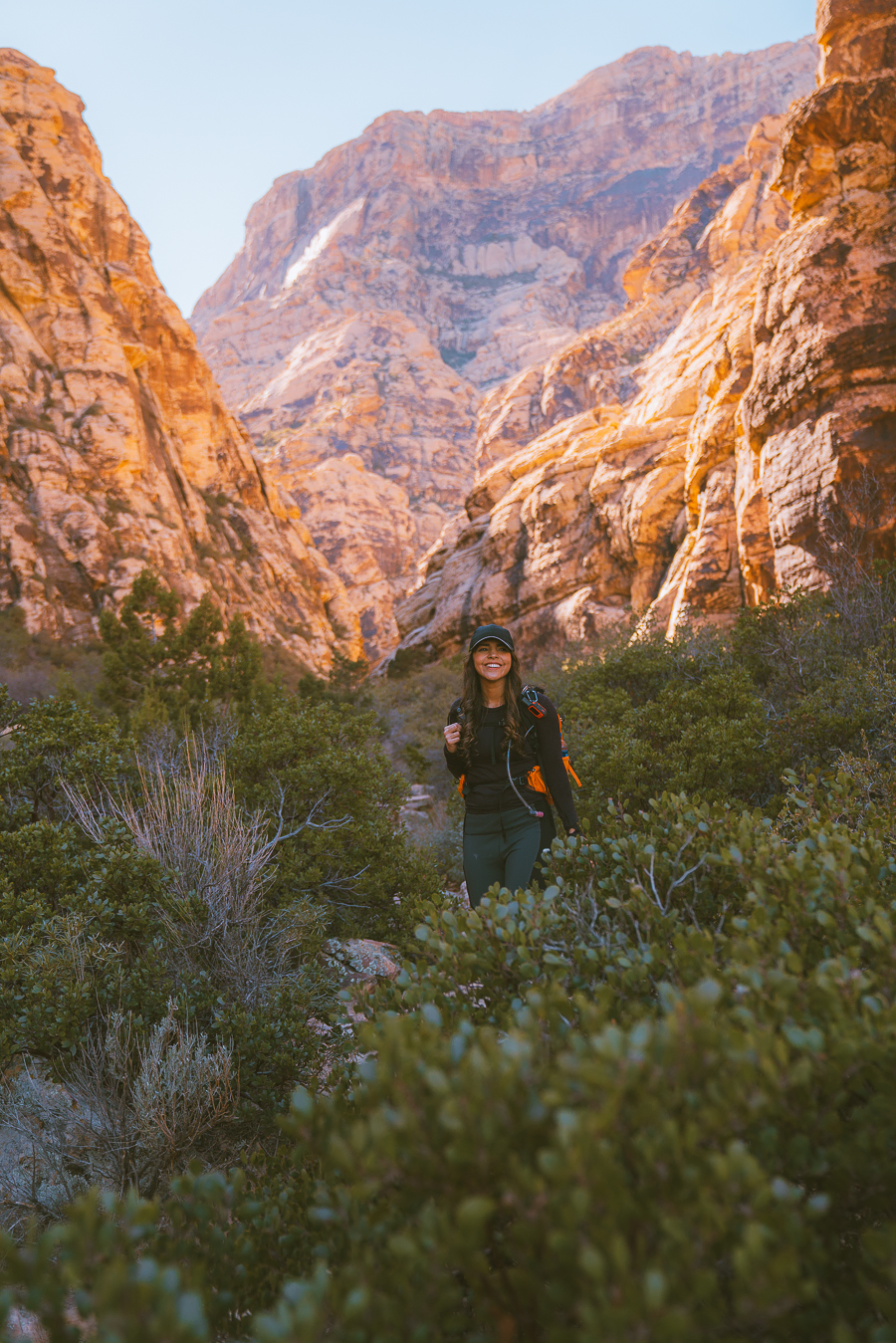
Ice Box Canyon is a stunning trail with views of the Bridge Mountains. It looks completely different than the other side of the park. The rocks here have a yellow and black tint to them, and they are much taller. It feels completely different than the Calico area (which is why I enjoyed it a lot).
The trail takes you deeper and deeper into the canyon, and mountains surrounds you on both sides. It is such a fun and unique trail. There is a lovely waterfall if you get to the end, but you don’t have to hike the whole trail to enjoy it. The views are pretty epic everywhere.
Just make sure you bring good hiking boots because it is easy to roll your ankles on this trail. The trail gets pretty difficult in the end. Don’t let that stop you from hiking this trail. As I mentioned, even doing one mile of this trail is worth it!
Keystone Thrust
- Distance: 2.4 miles, roundtrip
- Elevation Gain: 567 ft.
- Route Type: Out And Back
- Difficulty: Moderate
- Trail Guide: Link
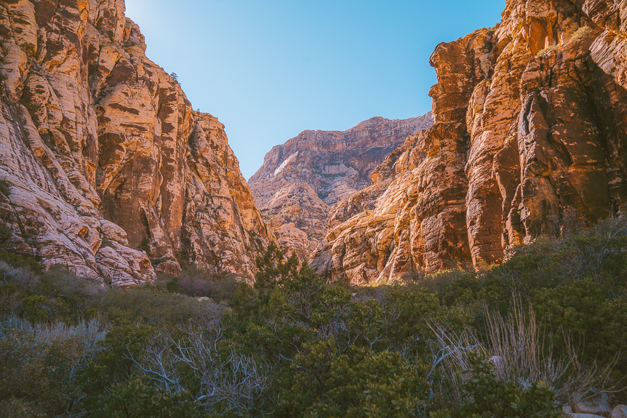
Geologically the Keystone Thrust is the most interesting trail at Red Rock Canyon. The Keystone Trust was formed due to compressional tectonic plates (Pacific and North American) pushing against each other, creating one of the best hikes at Red Rock Canyon. The trail is moderate and can contain Spring flowers.
Final Thoughts On Best Trails Red Rock Canyon
Thanks for reading about the best Red Rock Canyon hikes. Make sure to check out some of my other southwest blog posts:
- 21 Of The Best Grand Canyon Views
- The Ultimate Arizona Road Trip Itinerary
- The 13 Best Hikes In Sedona Arizona
- The Ultimate Las Vegas To Valley Of Fire Day Trip Itinerary
- 16 Amazing Weekend Trips From Las Vegas

new on the shop
The Ultimate Camping Trip Planner!
Our camping trip planner helps you stay organized and plan all aspects of your adventure so that you can conquer new territories with ease.


