Best Columbia River Gorge Hikes | 21 Breathtaking Trails
If you’re an avid hiker looking for a jaw-dropping adventure trekking through some of the most gorgeous natural landscapes, look no further than these Columbia River Gorge trails.
These Columbia River Gorge hikes have plenty to offer, from scenic paths through colorful wildflowers to exciting mountaintop views and national parks. Of course, the Columbia River runs proudly through the gorge and creates a beautiful scene, not to mention the numerous waterfalls like Tunnel Falls or Multnomah Falls.
There’s no doubt these hikes in the Columbia River Gorge will be well worth your time. So, what are you waiting for? It’s time to lace up those hiking boots, fill your water bottle, and prepare for your next adventure.
Disclosure: This post contains affiliate links. If you click one of them, I may receive a small commission (for which I am very grateful for) at no extra cost to you.
Columbia River gORGE
Related Posts
Map Of Best Columbia River Gorge Hikes
Best Time to Go Hiking in Columbia River Gorge
Any time of year is good when visiting the Columbia River Gorge, with each season offering unique charms and stunning sights. So, ultimately, there is no single time of year better than another.
However, two main periods for visiting are popular in Columbia River Gorge for different reasons. If you’re looking to see the gorgeous orchards and wildflowers in full bloom, then April is your go-to. Spring months (March to May), in general, are an excellent time for hikers wanting to enjoy the lush greenery before the temperatures get too high.
Summertime can get quite hot, with daily averages of 81°F (27°C) in July and August, so if you want milder weather, you can visit around the fall (September to November). This time offers a lovely temperate climate, fewer crowds (not that you’d notice in the large canyon), and incredible foliage with the classic orange and yellow hues of fall.
Finally, for those of you wanting to marvel at the splendor of the gorge waterfalls, visiting in late February or early March is best. As winter comes to a close, the snowmelt results in the waterfalls being at their highest flow.
How to Get to Columbia River Gorge
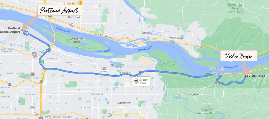
Luckily, accessing Columbia River Gorge is pretty easy to do, depending on which direction you’re coming from.
If you’re traveling from Portland, Oregon, you can enter via the Interstate 84 freeway for around 22 miles. This is about an 30-minute drive from there to the Columbia River Gorge National Scenic Area.
When coming from Seattle, Washington, taking the Interstate 5 South is the most direct route, with a traveling distance of about 200 miles (322 km), taking roughly three hours. This leads to the gorgeous scenic route on the Historic Columbia River Highway.
All the best views in the state
100+ WA Hikes
Embark on Washington’s best trails with our eBook! Inside, find top hikes, expert tips, and stunning views, making every adventure unforgettable. Dive into the beauty of Washington’s outdoors now!
How Much Time Do You Need for Columbia River Gorge Hiking?
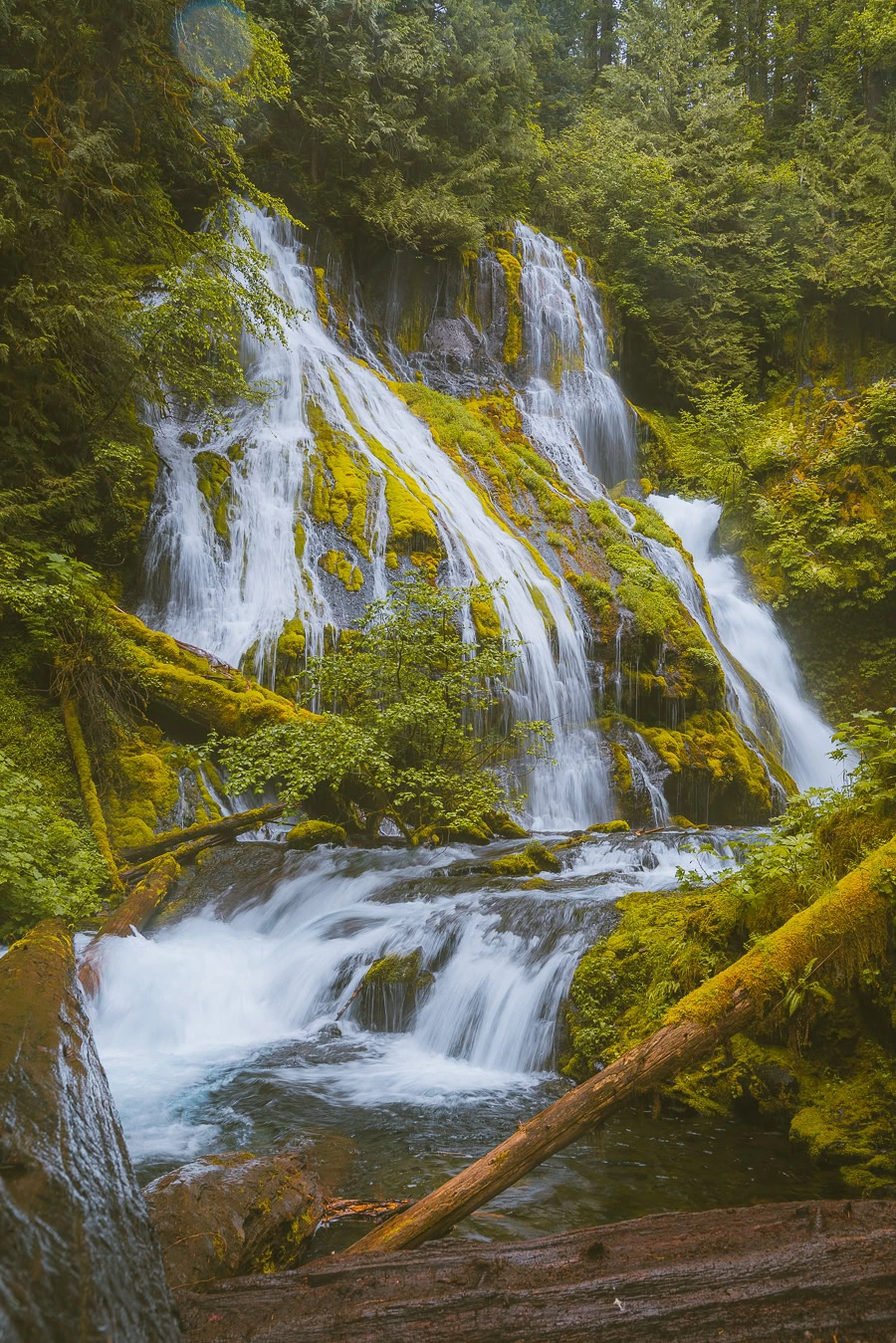
Columbia River Gorge runs about 80 miles (129 km) long, so there is a lot to see, and the more time spent there, the better. So, a good amount of time to spend here is around three days.
That way, you can explore many more spots, try more hiking trails, and not feel rushed. This is especially true if you want to see hallmark locations like Multnomah Falls, Little Hamilton Mountain, or Beacon Rock State Park.
It’s possible to enjoy your trip there in a single day, with an easy hike and a visit to one or two waterfalls, but the real treat is being able to savor each experience and location.
Where to Stay When Hiking in Columbia River Gorge
Now, if you’re going to be spending a few days traversing the gorge, you’re going to need somewhere to rest your weary head. Luckily, there are plenty of accommodation options. Here are the top choices of where to stay in Columbia River Gorge.
Luxury | Skamania Lodge
There’s nothing wrong with splurging on a dream trip, so why not spend a few nights in a luxury lodge in Stevenson, Washington? Skamania Lodge is the perfect blend of rustic charm and modern beauty.
Sitting alongside the Columbia River, you have access to some of the best hiking trails, nearby waterfalls, and stunning views of the surrounding mountains and forests. Not to mention the amenities, like an on-site spa, tennis court, in-house restaurants, and a golf course. >>>Check Availability
Mid-Range | River Lodge and Cabins
This one is great for a combination of a reasonable price and a fantastic experience. River Lodge and Cabins in Boardman, Oregon, is your go-to. The simple modern design pairs wonderfully with a cozy charm in each available room.
Besides the river views and surrounding landscape, this accommodation sports a private beach area, room service, the River Lodge and Grill restaurant, a fitness center, and bike rental. Plus, it’s only 1.2 miles from Port Marrow and about 56 miles from the Tri-Cities Airport for added convenience. >>>Check Availability
Budget | Celilo Inn
If you think you can’t get a stellar hotel experience without breaking the bank, think again. The Celilo Inn in The Dalles, Oregon, is right up there in terms of service, spacious and comfortable rooms, and proximity to great hiking trails in the Columbia River Gorge.
This inn has an outdoor pool for you to enjoy, an outdoor fireplace, bedroom amenities, a parking lot, and a coffee maker. There’s also a fitness center on-site. If that wasn’t enough, there are free bicycles to explore the area around the hotel. >>>Check Availability
Camping in Columbia River Gorge
The Columbia River Gorge National Scenic Area has plenty of campsites to choose from across the 80-mile (129 km) stretch, ranging from tent to RV sites. The easiest way to find some great campgrounds would be by visiting one of the Oregon or Washington State Parks.
Ainsworth State Park (48 campsites), Beacon Rock State Park (26 campsites), or Viento State Park (56 campsites) are all great options, but there are plenty more on offer.
Apart from state parks, there are a few standalone sites, like Eagle Creek and Wyeth Campgrounds, down in Cascade Locks, Oregon. >>>Find Out More
20 Best Hikes In Columbia River Gorge
Now, it’s finally time to get into what you’re here for – the best Columbia Gorge hikes. Whether you’re looking to trek up Dog Mountain or Beacon Rock or relax on some great waterfall hikes, these hiking trails are suited for anyone, from beginners to pros.
1. Cape Horn Trail
- Elevation Gain: 1,404 feet
- Mileage: 6.8 miles (loop)
- Difficulty: Moderate
- Trail Guide: Link
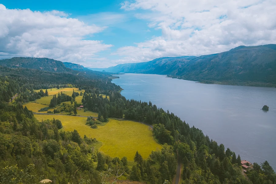
Washington is home to some of the best hikes in the world, and this trail is no exception. The Cape Horn Trail runs through luscious wooded areas and up to Pioneer Point, where you can experience breathtaking views of the valley and river below. Not only that, but you’ll pass by a few waterfalls too.
You can enjoy the gorgeous views with your family and even bring your four-legged friend along (as long as you have a leash). The trail isn’t too strenuous, so you can take things up a notch and run the route. Oh, and the trail is fantastic for birding, too.
2. Beacon Rock Trail
- Elevation Gain: 574 feet
- Mileage: 1.5 miles (out-and-back)
- Difficulty: Moderate
- Trail Guide: Link
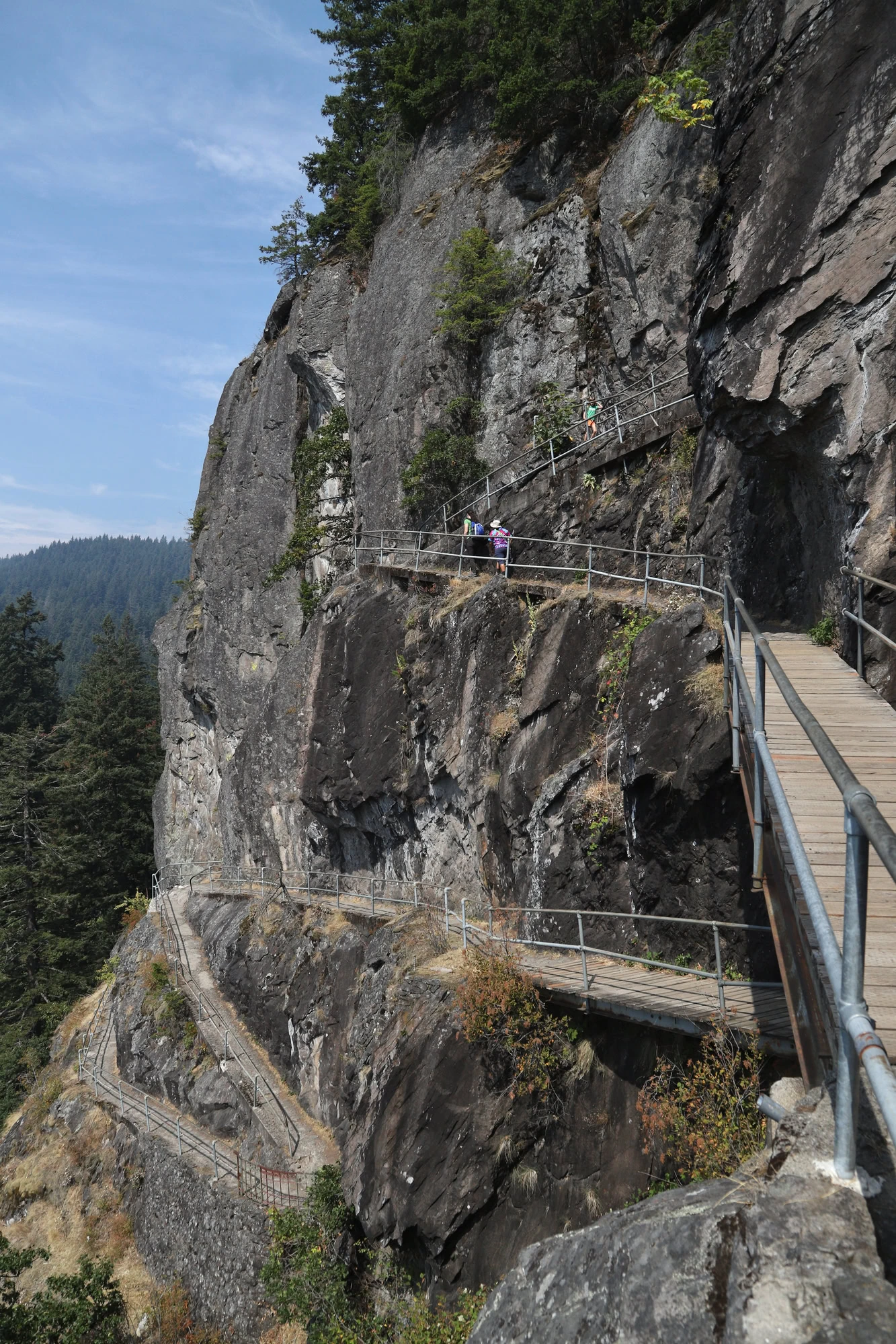
Next up, you’ve got this fantastic route nestled within the gorgeous state park. This Beacon Rock Trail length is relatively short, making it one of the easiest hikes in the gorge. It also has a partially paved path, so it’s child and pet-friendly — perfect for the whole family to enjoy.
The trail begins near the main parking lot and heads to a bridge as you walk out of the lush forest. The trail’s highlight is, of course, Beacon Rock itself, where you can hike up the steps along the side. Once you reach the top of North and South Summit Viewpoints, you’ll be astounded by the panoramic views of the gorge below.
Download my free Outdoor Photography Guide
3. Hamilton Mountain Trail
- Elevation Gain: 2,057 feet
- Mileage: 5.4 miles (out-and-back)
- Difficulty: Hard
- Trail Guide: Link
The Hamilton Mountain Trail is undoubtedly one of the best hikes in the Columbia River Gorge, especially for more experienced hikers. Not only is this a longer hike, but it’s more strenuous as it takes you up through steep hills and wooden stairs up Little Hamilton Mountain. Don’t forget to set aside more time since this hike can take up to three hours and 45 minutes to finish.
Like many other hiking trails, this one is pet-friendly as long as your pup is leashed up. You’ll pass by Rodney Falls along the way up and, unsurprisingly, marvel at the views of the Columbia Hills and river once you reach Hamilton Mountain Summit.
4. Dog Mountain Trail
- Elevation Gain: 2,989 feet
- Mileage: 6.5 miles (loop)
- Difficulty: Hard
- Trail Guide: Link
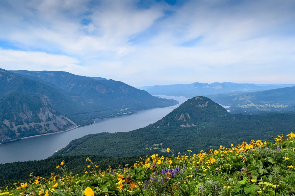
This trail on Dog Mountain is likely one of the more difficult on the list but also one of the most rewarding. The 6.5-mile route will take around five hours to complete, so remember to pack extra snacks and some fresh water to keep hydrated.
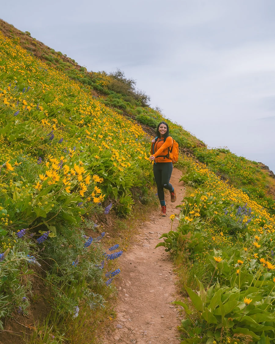
You’ll pass by the usual green forests as you move up Dog Mountain, but the most stand-out feature of this path has to be the gorgeous, colorful wildflowers that adorn the hills. It’s truly a view worth the extra effort.

Top Tip: During wildflower season (April to June), you’ll need a Dog Mountain Trail System Permit to access this trail.
5. Coyote Wall Trail
- Elevation Gain: 1,765 feet
- Mileage: 6.3 miles (loop)
- Difficulty: Moderate
- Trail Guide: Link
The Coyote Wall loop trail is situated in White Salmon, Washington, and offers a moderately challenging hike, boasting steep hills and views of Mount Hood and the gorge below. As you’d expect from any decent trail in the canyon, the Columbia River is in perfect view. You’ll stroll past a couple of waterfalls here, too.
Like Dog Mountain, there are beautiful wildflower meadows along the trail that you can expect to see, but this time, you don’t have to worry about a permit to access them during the springtime. The trail is incredibly popular for mountain biking, too, if that’s what you’re into. Definitely worth the visit.
6. Mosier Plateau Trail
- Elevation Gain: 728 feet
- Mileage: 2.7 miles (out-and-back)
- Difficulty: Moderate
- Trail Guide: Link
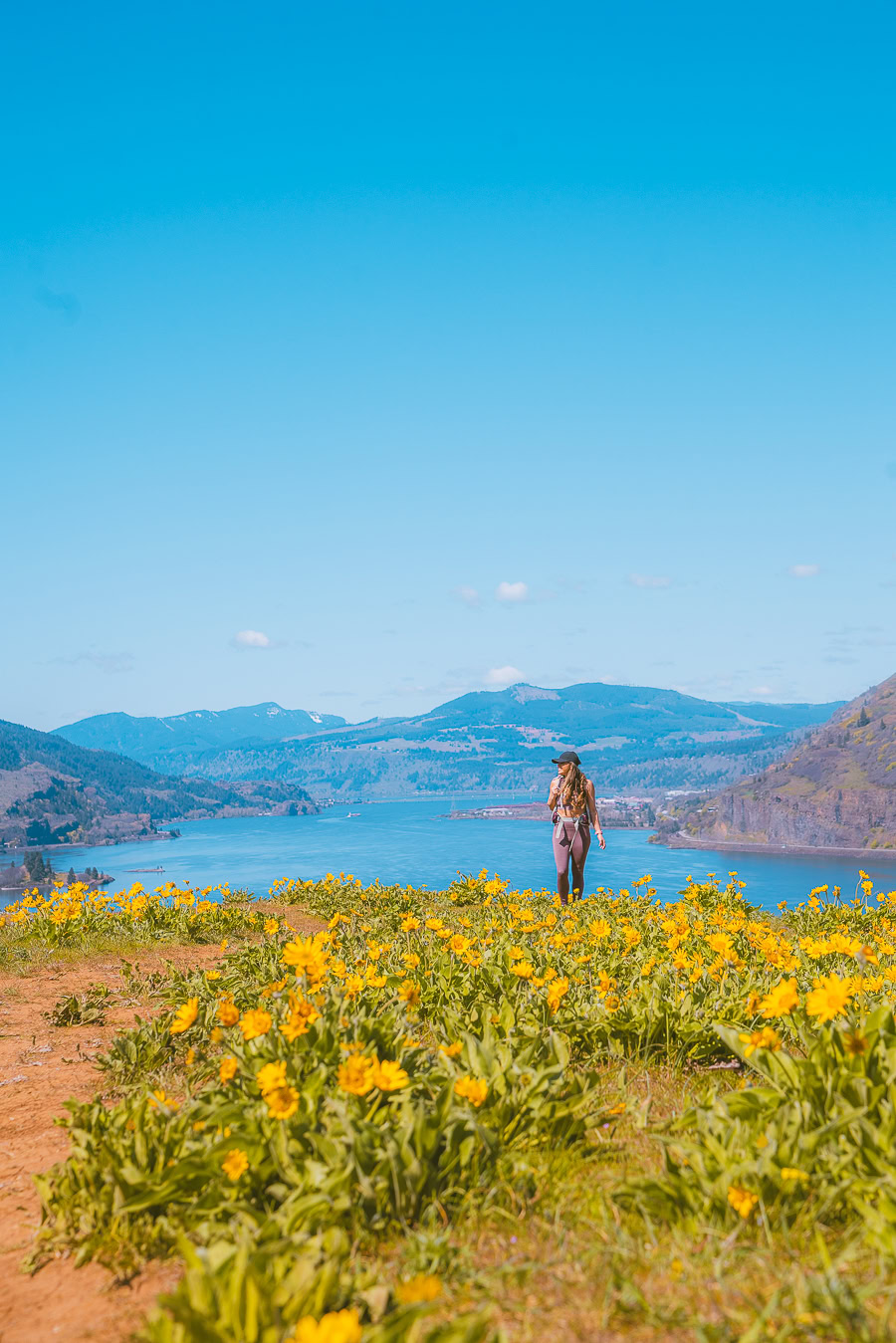
Want to spend some time in the fresh open air, away from the dense cover of the forest trees? Well, this trail is for you. The focal point has to be the vast meadows and open space you’ll cross, which, like other places, have stunning wildflowers that bloom in spring.
You will come across a waterfall or two along your journey and calming creeks where you can take a breather. This Columbia Gorge hike is also family and (leashed) pet-friendly, popular for both walking and running. Plus, birdwatchers can catch a glimpse of the local bird life, including the Californian Scrub Jay or Western Sandpiper.
7. Latourell Falls
- Elevation Gain: 640 feet
- Mileage: 2 miles (loop)
- Difficulty: Moderate
- Trail Guide: Link
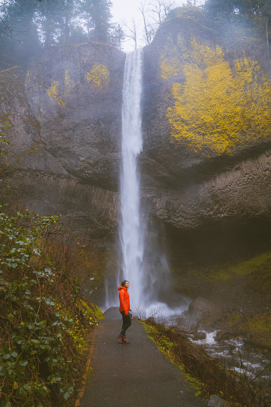
It’s time to look at a few waterfall hikes, starting with the Latourell Falls loop trail. This trailhead is in Guy W. Talbot State Park and leads through tree-lined forests up to the Upper Latourell Falls. The super green forests are stunning in spring and summer, but the orange and yellow hues of fall are perfect for some hiking photography.
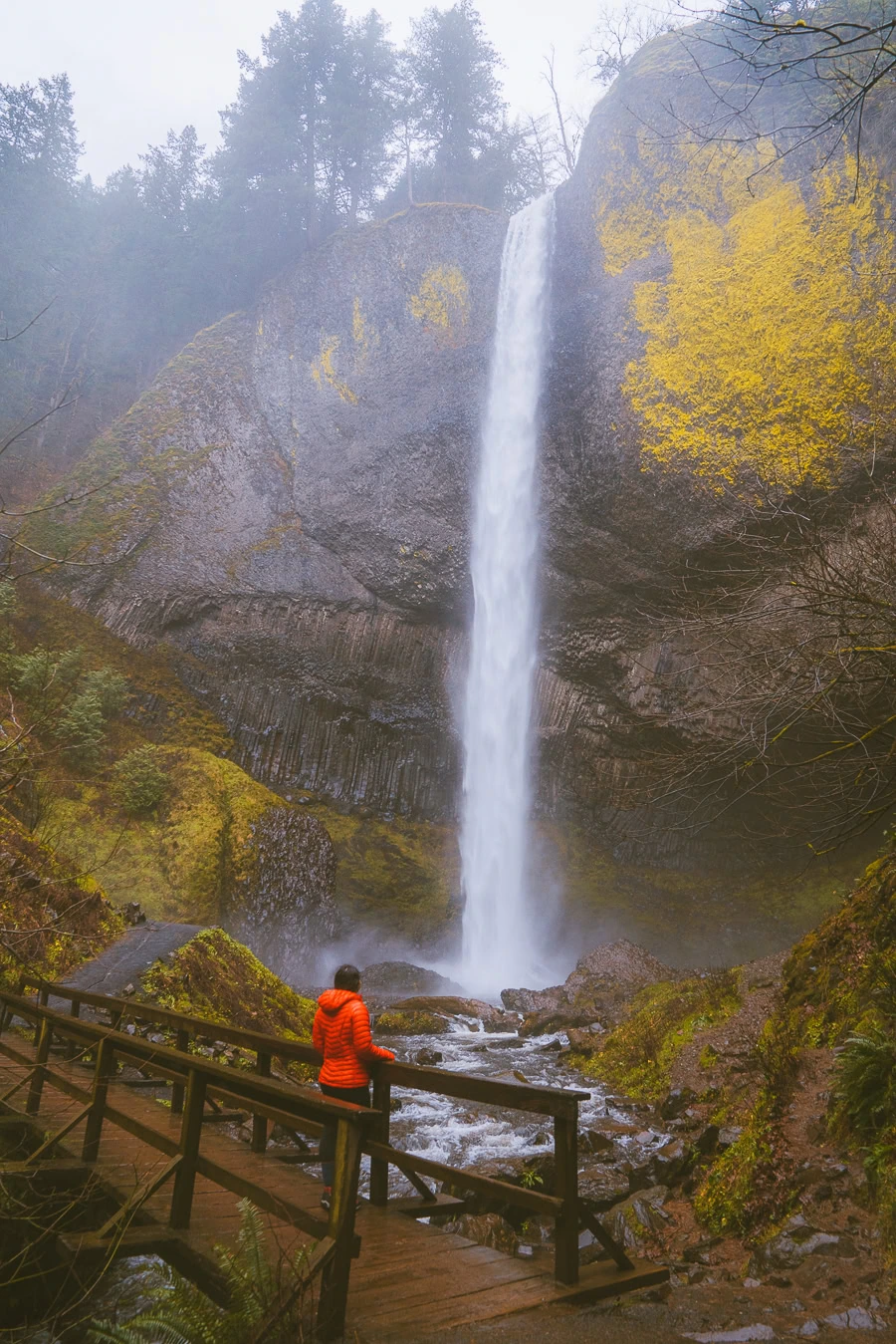
Remember that if you’re trying this trail out on a rainy day, you’ll need some good-quality, grippy shoes, especially on the smoother rocks of Upper Latourell Falls. The last thing you want to do is slip and risk injuring yourself.
new on the shop
The Ultimate Camping Trip Planner!
Our camping trip planner helps you stay organized and plan all aspects of your adventure so that you can conquer new territories with ease.
8. Bridal Veil Falls
- Elevation Gain: 121 feet
- Mileage: 0.6 miles (out-and-back)
- Difficulty: Moderate
- Trail Guide: Link
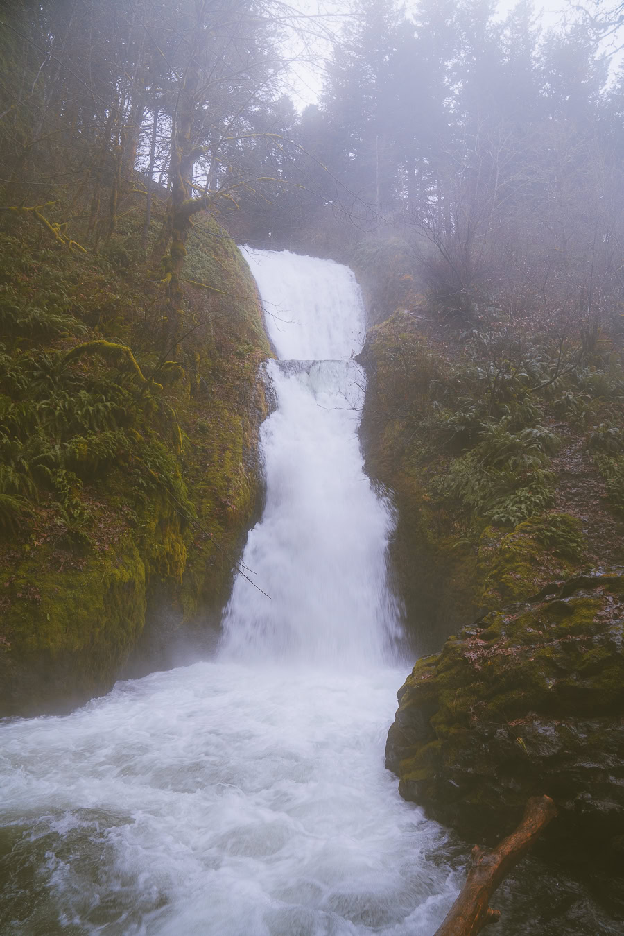
The Bridal Veil Falls trail is the second shortest on the list, but that doesn’t mean it falls short on the scenery. From the looming pine trees to birds chirping and flowing creek water, this trail is a relaxing retreat from life’s hustle and bustle.
You’ll travel from Bridal Veil Falls State Scenic Viewpoint to the waterfall, with two drop points summing up to 120 feet, making it an impressive sight. A wooden staircase will take you up the steepest part of the trail. In the end, you’ll be rewarded with one of the most enchanting sites the gorge offers.
9. Wahkeena Falls
- Elevation Gain: 942 feet
- Mileage: 3.1 miles (out-and-back)
- Difficulty: Moderate
- Trail Guide: Link
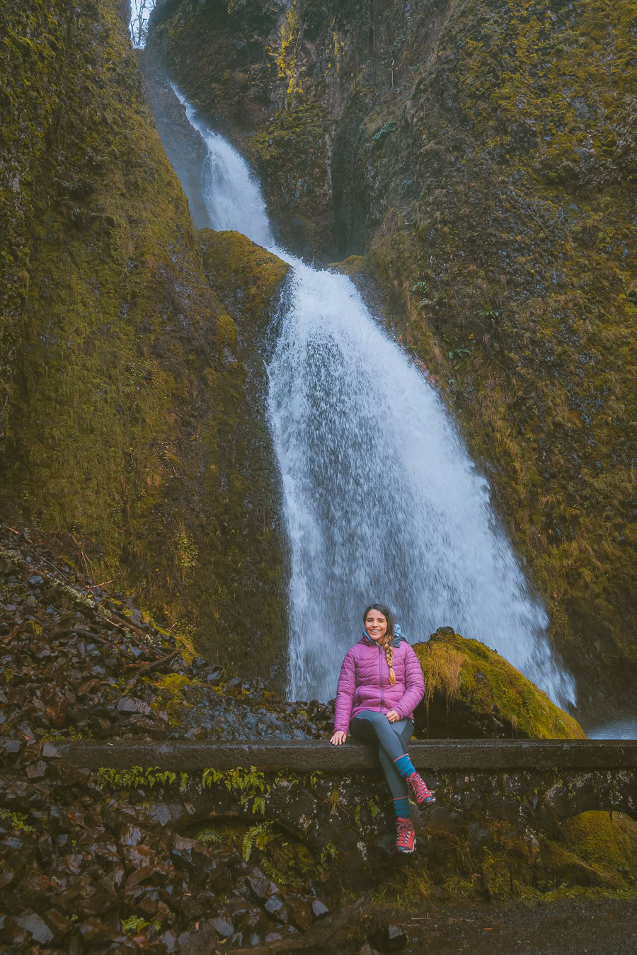
Wahkeena Falls is situated near Bridal Veil in Oregon and has a similar difficulty, albeit a bit longer in distance. The trail is perfect not only for hikers but for birdwatchers as well. The path is partially paved, too, so it makes it slightly more accessible for children, dogs, and beginner hikers.
Be wary, though, as there are plenty of sharp drops along the way, including a creek crossing along the path. It isn’t recommended for those of you scared of heights. As a bonus, you’ll pass nearby other stunning waterfalls, like Multnomah (up next).
10. Multnomah Falls
- Elevation Gain: 814 feet
- Mileage: 2.6 miles (out-and-back)
- Difficulty: Moderate
- Trail Guide: Link
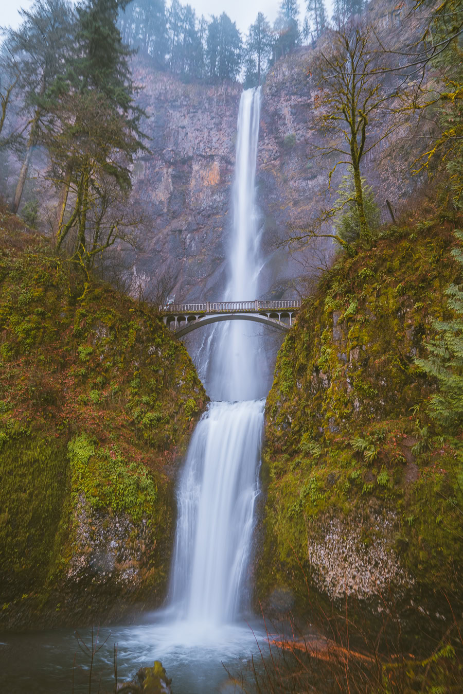
You know how they say to save the best for last? Well, that isn’t the case here. If you find yourself in Multnomah Creek, check out this beautiful waterfall trail that offers you a one-hour and 36-minute journey up to the most impressive waterfall in Columbia River Gorge. It’s also the tallest waterfall in the gorge, with a 620-foot drop.
The trail starts at the parking lot near the Columbia River Highway, then moves along with some benches to rest on and unbeatable scenery you can expect from the canyon. There’s also a nice bridge to cross in front of the waterfall for some photo-worthy moments. From there, you’ll hike up to the vantage point at the top of the falls.
11. Horsetail Falls and Ponytail Falls
- Elevation Gain: 331 feet
- Mileage: 0.9 miles (out-and-back)
- Difficulty: Moderate
- Trail Guide: Link
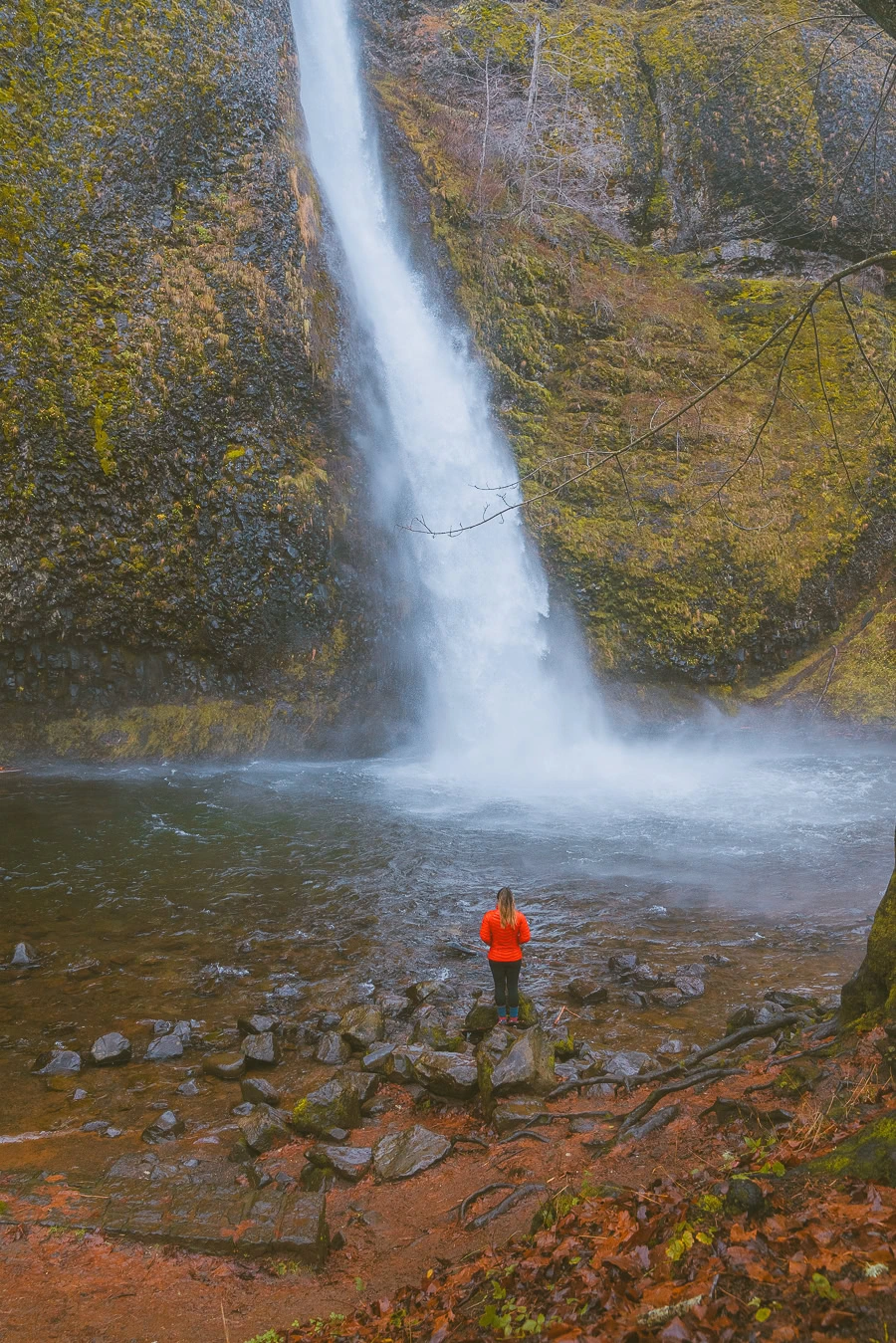
The Ponytail and Horsetail Falls might be classified as a moderately difficult trail, but it’s a pretty easy hike compared to others on the list, with a nice and laidback 0.9-mile path. However, the rocky paths can get slippery, particularly when trekking behind the waterfalls, so always have good, comfy, and sturdy shoes.
This trail is wonderful, as it takes you past not one but two waterfalls: Horsetail Falls and Ponytail Falls. The former is easy to access via the nearby road, but the latter is slightly trickier, with loose rocky paths. But in the end, you can walk behind Ponytail Falls, which is completely worth it.
12. Dry Creek Falls via Pacific Crest Trail
- Elevation Gain: 899 feet
- Mileage: 4.4 miles (out-and-back)
- Difficulty: Moderate
- Trail Guide: Link
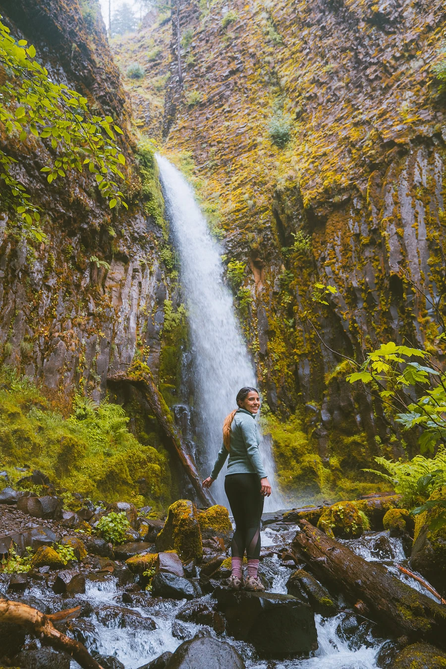
This gorge trail takes you along a 4.4-mile long route near Cascade Locks, which is another attractive option for hikers. The Dry Creek Falls trail is perfect for beginner hikers, despite being slightly longer, as the route is easy to traverse and nicely marked, so simple to follow.
The trail is open year-round, so you can enjoy the gorgeous trees, creeks, wildlife, and some picturesque wildflower meadows, all before reaching the waterfall itself. Dry Creek Falls is the perfect spot to relax at the end of your first stint, take a picnic, or even squeeze a quick dip in the pool next to it.
13. Spirit Falls
- Elevation Gain: 433 feet
- Mileage: 0.7 miles (out-and-back)
- Difficulty: Hard
- Trail Guide: Link
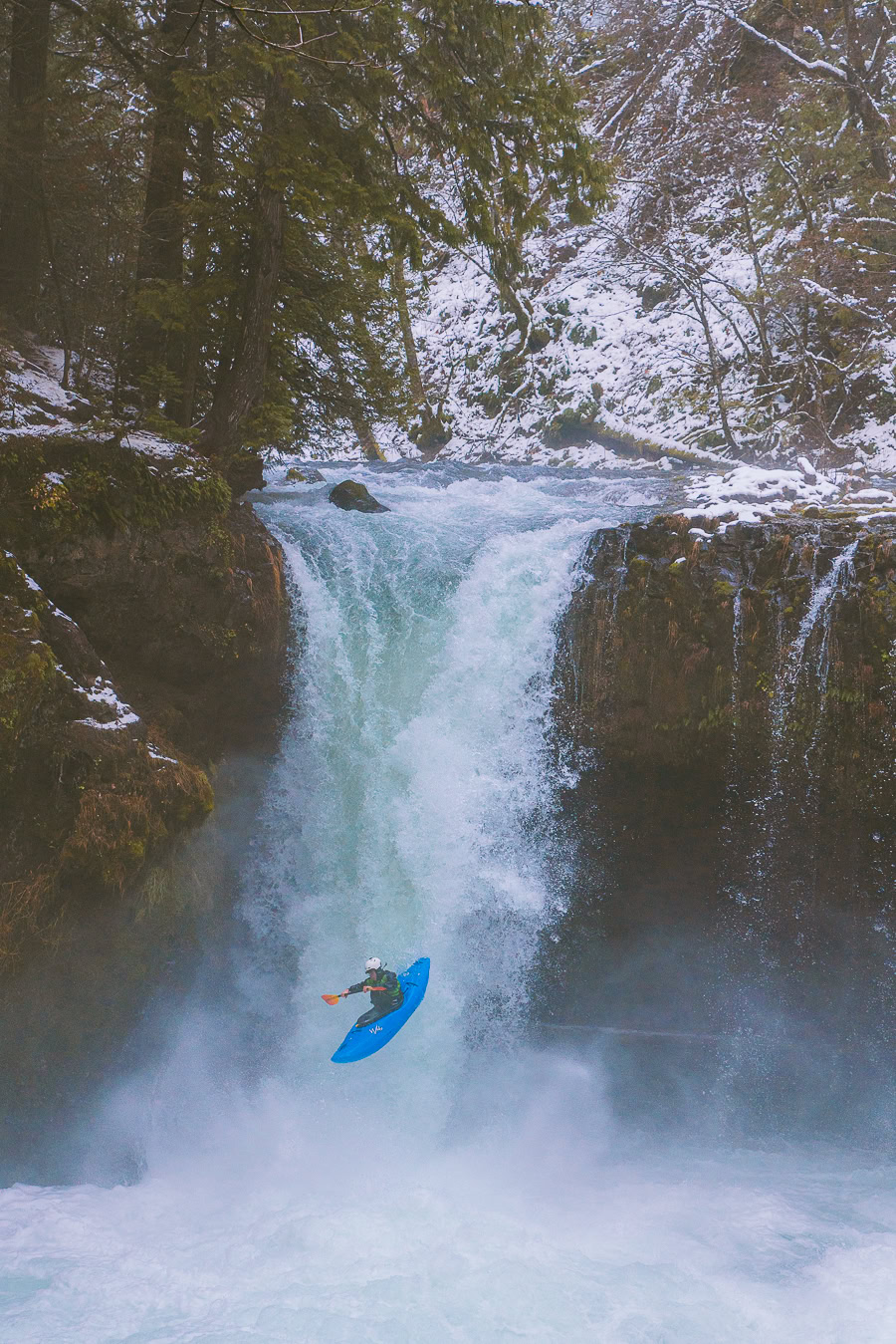
The Spirit Falls trail is an excellent option for more experienced hikers. While the trail length is reasonably short, it’s quite slippery, rocky, and challenging to navigate, so it’s best to leave the kids at home for this one.
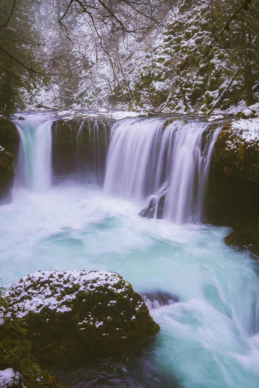
That said, once you find your way along the trailhead or one of the other unofficial pathways, you’ll be rewarded with a stunning view of the waterfall. Remember, though, that the waterfall is on private property, so make sure to follow any signage and respect their instructions.
14. Panther Creek Falls
- Elevation Gain: 115 feet
- Mileage: 0.3 miles (out-and-back)
- Difficulty: Moderate
- Trail Guide: Link
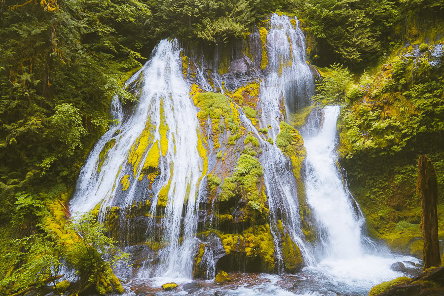
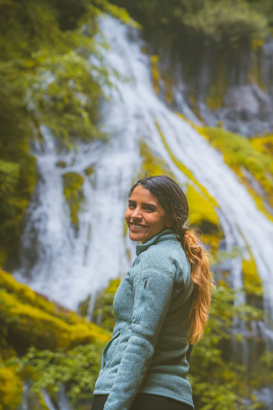
The hike to Panther Creek Falls in Skamania County is the shortest trail on the list, so if you want the quickest walk possible, this is your go-to. It’s an easy hike in some respects, but it can be moderately challenging for some due to the slippery ground and forest vegetation. Don’t let that deter you, though.
This trail is both kid and pet-friendly, too, so the whole family is welcome. The parking lot is around 5.8 miles up Wind River Road, where you’ll find the starting trail leading up to the viewing platform at the falls. Once you’re there, you can marvel at the beauty and uniqueness of the two-tier waterfall.
15. Lower Falls Creek Trail
- Elevation Gain: 699 feet
- Mileage: 3.2 miles (out-and-back)
- Difficulty: Moderate
- Trail Guide: Link
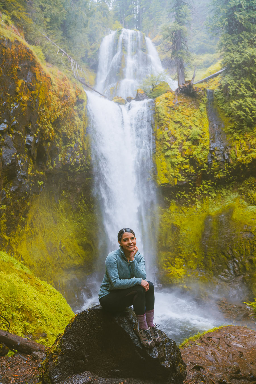
Another addition to the list of Columbia Gorge hikes is the Lower Falls Creek trail out in Carson, Washington. This trail is extremely popular, not just for hikers, but birdwatchers, mountain bikers, and even horseback riders (so don’t be spooked if a horse comes trotting passed).
The trail sports that classic gorge natural beauty, taking you through the dense forest alongside a creek until you reach a beautiful waterfall. The best part about it is the mist from the falls as you stand nearby, perfect for cooling down on a hot day. But since it’s so popular, you might want to catch a hike extra early to beat the crowds.
16. Eagle Creek Trail
- Elevation Gain: 4,826 feet
- Mileage: 25.8 miles (out-and-back)
- Difficulty: Hard
- Trail Guide: Link
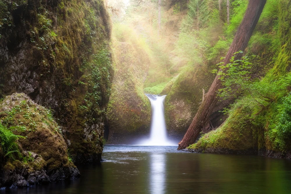
The Eagle Creek trail is another one for the pros among you, as it’s pretty challenging to get through — seriously, it isn’t for the faint of heart. Consider other gorge hikes that are shorter if you don’t feel up to the 12-hour and 30-minute journey this trail offers.
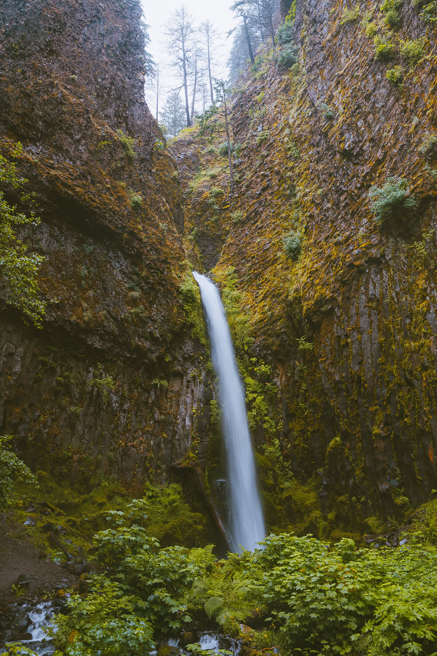
This trail begins at the Eagle Creek Trail Campground and passes through long stints of forested areas, wooden bridges, and incredible wildlife and flowers, so take your time to bask in the scenery. You’ll also pass by five waterfalls: Metlaka Falls, Punchbowl Falls, Loowit Falls, Tunnel Falls, and Twister Falls.
17. Angel’s Rest
- Elevation Gain: 1,490 feet
- Mileage: 4.5 miles (out-and-back)
- Difficulty: Hard
- Trail Guide: Link
Angel’s Rest is a very popular hike for well-versed hikers and runners alike. While the trail for Angel’s Rest length isn’t too long, the route itself isn’t the easiest to get through, with thick overgrown vegetation and rocky terrain.
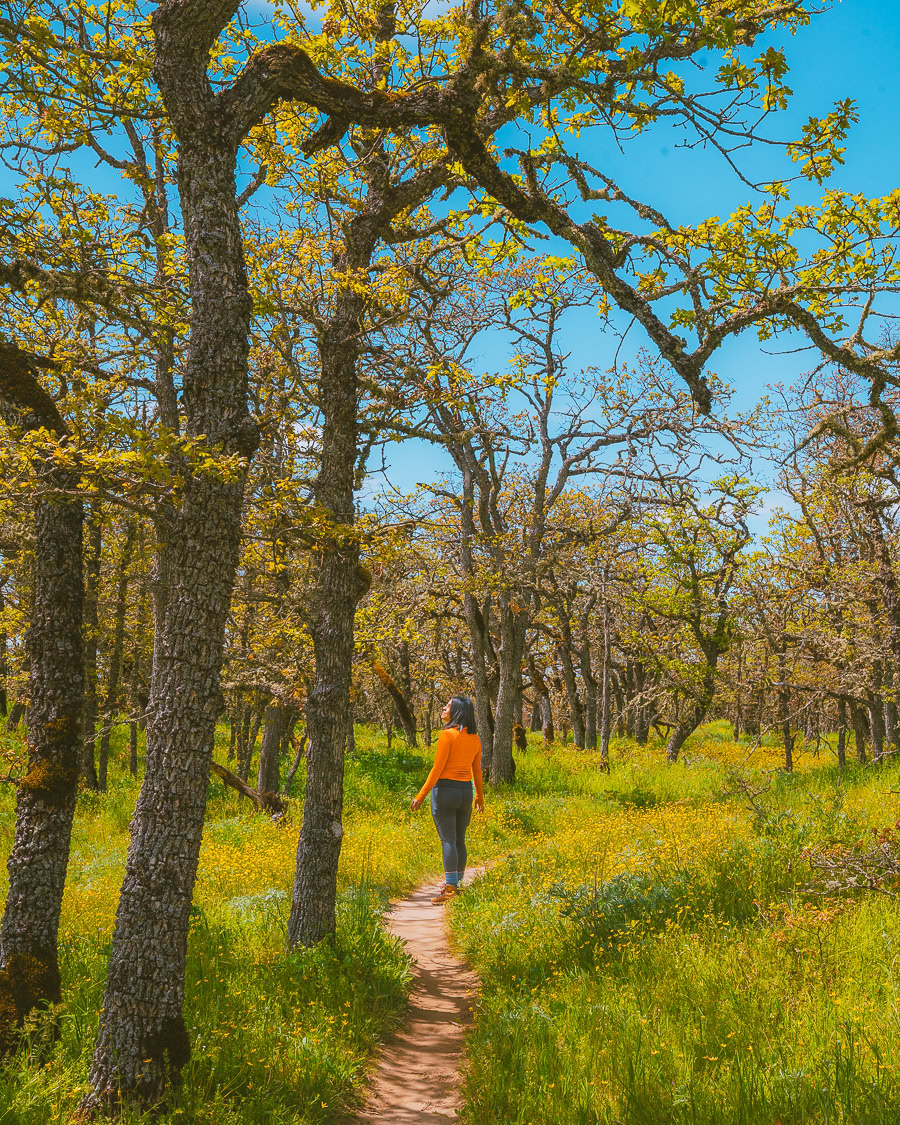
That said, the views are well worth the extra trouble. You’ll pass by gorgeous oak and pine trees, blueberry bushes, rock formations, bridges — you name it. The highlights from this trail have to be the Coopey Falls’ upper and lower viewpoints and the top of Angel’s Rest, where you’ll get a breathtaking 360-degree view of the gorge.
Download my Washington Hiking Checklist!
18. Table Mountain Trail via Pacific Crest Trail
- Elevation Gain: 4,215 feet
- Mileage: 15.3 miles (out-and-back)
- Difficulty: Hard
- Trail Guide: Link
The Table Mountain trail via PCT in North Bonneville, Washington, is another longer hike to add to the list, coming in at around 16.4 miles long. It’s a very challenging route, too, with plenty of loose rocks and steep inclines, so be careful. It’s also popular for birdwatching and rock climbing.
Keep in mind that the only trailhead you’ll be able to access is the Bonneville trailhead, and you’ll also need a Northwest Forest Pass (or pay a fee) to access the trail. Yet, it will all be worth it once you see the blossoming flowers, lively wildlife, and, of course, the views at the summit of Table Mountain.
19. Gorge River Trail to Tanner Creek
- Elevation Gain: 1,375 feet
- Mileage: 6.9 miles (out-and-back)
- Difficulty: Moderate
- Trail Guide: Link
This trail has to be one of the best Gorge hikes in Oregon, great for hikers, runners, mountain bikers, and birdwatchers alike. It’s found on the John B Yeon State Scenic Corridor and runs about 6.9 miles long alongside the Columbia River.
The trail boasts immaculate views of the gorge, the river, wildflowers, lush vegetation, and forests (did you expect anything less?). Again, like most trails, the doggos are allowed as long as they’re on a leash. The only thing to remember is that the route is only accessible up to McCord Creek due to a partial closure, so keep an eye on future updates.
20. Sleeping Beauty Trail
- Elevation Gain: 1352 feet
- Mileage: 2.4 miles (out-and-back)
- Difficulty: Moderate
- Trail Guide: Link
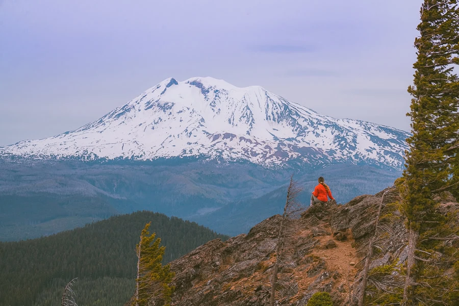
The Sleeping Beauty Trail is a top-notch trail. While this trail is not exactly in the gorge itself, it’s still worth mentioning. It’s found in Gifford Pinchot National Forest in Washington, between Mount St. Helens and Mount St. Adams, just north of the Columbia River. But what makes this trail so special?
The trail has a hefty 1352-foot elevation, so it’s more challenging but worth the sweat. Most of the trail is covered by a forested canopy, so you don’t need to worry about the scathing sun because the cool breeze helps. Always pack extra clean water, as there are no places to stop and refill.
Once you reach the summit, where there used to be a fire tower lookout, you’ll be met with views of the nearby mountains and the Indian Heaven Wilderness. It’s definitely a view out of a fairytale.
21. Lyle Cherry Orchard Trail
- Elevation Gain: 1,213 feet
- Mileage: 5.0 miles (out-and-back)
- Difficulty: Out & back
- Trail Guide: Link
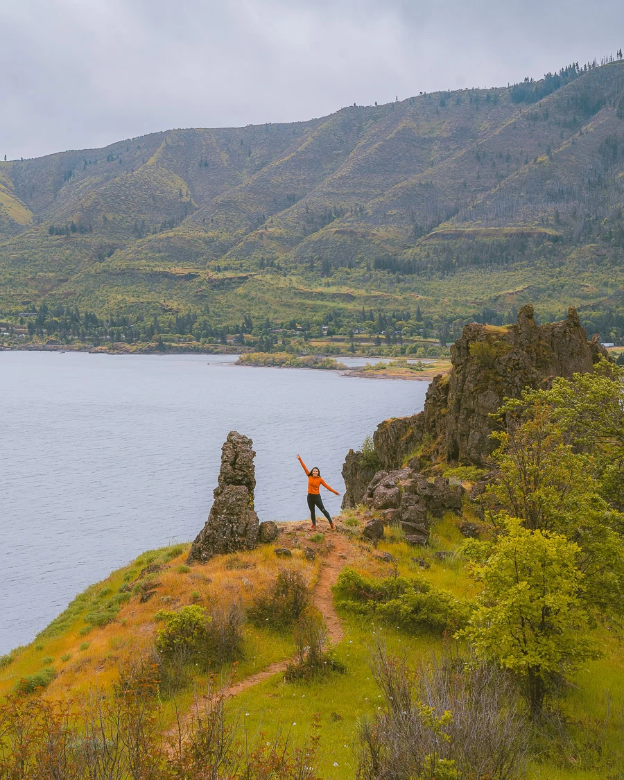
The perfect spot to be during spring is the Lyle Cherry Orchard Trail. This hike offers stunning views of the Gorge, and if you visit during April or May, you might encounter wildflowers like balsamroot and lupines. At the end of the hike, there’s a loop surrounded by breathtaking cherry trees, with even more wildflowers at the base of the trees. This truly is a wonderful and beautiful trail for anyone who loves flowers. Be careful of rattlesnakes and ticks! There are many on the trail, so stay on the path.
What To Pack For The Columbia River Gorge If You Are Hiking
- Sunscreen: It might be extremely sunny! >Buy Sunscreen
- Chapstick: This one has SPF so your lips won’t get burned! >Check Out This Chapstick
- Hiking Boots/Shoes: If you want to hike any of the trails (especially Spirit Falls) then you need some good quality hiking shoes. >Check Out My Hiking Shoes
- Hiking socks: Having the correct socks helps you prevent getting blisters. Smart Wool is probably my favorite brand out there. >Buy Hiking Socks
- Water Reservoir: Water reservoirs help prevent me from getting dehydrated while hiking. The great thing about this reservoir is that it doesn’t have a plastic taste. >Here Is My Water Reservoir
- Water: Stay nice and hydrated.
- Sunglasses: It can get sunny all year round, so make sure to pack some sunglasses. >Check Out These Sunglasses
- Snacks: The best snacks are jerky, nuts, and energy bars. >>>I Love These Bars
- Camera: The Sony A6000 was one of the first cameras I started traveling with. The Sony A6000 is an excellent camera for people that want to start improving at travel photography. >Buy Sony Camera Here
- First Aid Kit: This is one of the first things I bought when I first started going on adventures. It is super portable. >Buy This Awesome First Aid Kit Here
- Day Pack: To carry all your gear, water, and food, you need a good backpack. Osprey is known to have some of the best backpacks in the market. >Buy This Great Quality Backpack
- Headlamp: A headlamp is an absolute must in case you get stranded in the dark! It is a lot more portable and easier to use than a flashlight. >Buy A Headlamp Now
- Leggings or Hiking Pants: I always wear leggings while hiking because it is what I feel most comfortable with! >Click For My Favorite Hiking Leggings
- Breathable sweat-wicking shirts: Cotton shirts soak up your sweat when hiking, so make sure to wear something breathable. >Check out this awesome breathable shirt here.
- Mid Base Layer: If you are hiking in the winter, this might be a great idea. >Check Out My Sweater Here
- Sports Bra: For women. >Check This One Here
- Jacket: I always have a jacket in my backpack, even if it is hot. I do it just in case of an emergency. >Buy My Favorite Jacket
- Rain Jacket: The worst feeling in the world is being wet and cold while hiking. You can get hypothermia, so always carry a poncho or a rain jacket when you hike in Oregon. If you look closely at my pictures, it is raining in most pictures. >Check Out My Rain Jacket Here
- Tripod: This is an optional item, but it is excellent for getting the ideal silky waterfall pictures. >Check out this tripod
- Knife: I always carry a knife in my backpack just in case. >Check Out My Knife Here
Claim your FREE Hiking Checklist
Ready to start hiking? Grab my free hiking checklist and never forget anything at home!
Tours Of Columbia River Gorge
FAQs About Hiking In Columbia River Gorge
Do you still have some questions about the gorge? Don’t worry — here are a few of the most frequently asked questions around Columbia River Gorge to set your mind at ease.
What Is the Tallest Waterfall in Columbia River Gorge?
The tallest waterfall by a long shot is Multnomah Falls, with a staggering 620-foot drop (second only to Elowah Falls with 290 feet). This impressive waterfall is found in Multnomah Creek just east of Troutdale, and it’s definitely worth the trip.
The Multnomah Falls area is open year-round during the daytime and has plenty of amenities and services surrounding it. The visitor center, parking lot, restaurant, gift shop, snack bar, and restrooms are all open to visitors.
For access, you’ll need a waterfall corridor permit. A timed Multnomah Falls (I-84) permit costs around $2 (non-refundable) and gives you access to the area between 9 AM and 6 PM.
How Much Does It Cost to Go to Columbia River Gorge?
The overall cost of your trip to Columbia River Gorge depends on which areas you plan on visiting and what you get up to. Some sites require extra fees for full use of their services, and this excludes accommodation and travel costs.
Visitors can get a Northwest Forest Pass that lets them use all recreation sites on both the Washington and Oregon sides of the gorge. You can get a day pass for $5 or an annual Northwest Forest Pass for $30 if you’re a more frequent visitor.
If you visit Multnomah Falls, you’ll need a timed waterfall corridor permit ($2) to access the area and the Multnomah Falls parking lot. That said, you can skip out on the $2 charge on certain days that have free access, including Labor Day and Memorial Day, but make sure to check ahead.

Top Tip: Here’s more information on the Northwest Forest Pass, waterfall corridor permit, and other available passes and permits for the Columbia River Gorge Scenic Area.
What Is the Historic Columbia River Highway?
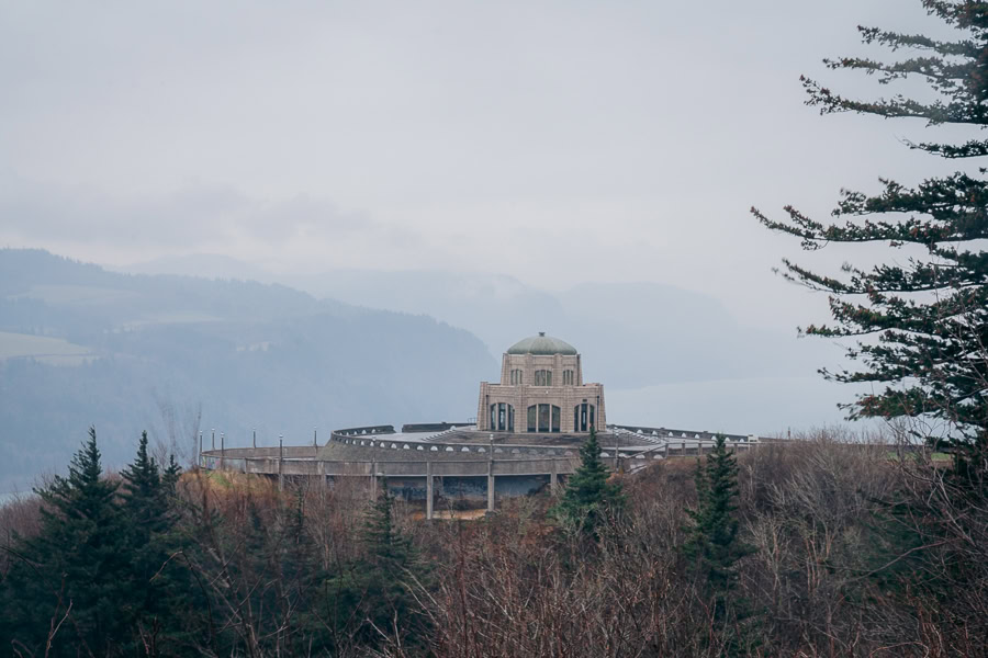
The Historic Columbia River Highway is a road initially constructed between 1913 and 1922 for travelers taking in the sights of the gorge. It can be accessed via car, bike, or by foot and will deliver the stunning views of the gorge you’re looking for.
Currently, you can only access around 68 of the original 73 miles of the Historic Columbia River Highway State Trail. It’s divided into three major trail segments: Bonneville, Mitchell Point, and Twin Tunnels.
Wrapping Up the Best Columbia River Gorge Hikes
At the end of the day, the 80-mile (129 km) stretch of the Columbia River Gorge is jampacked with incredible hikes. From looming mountains and gorgeous green forests to national parks and some of the best waterfall hikes in the US, you can’t go wrong with an adventure here.
That all said, it’s time to get your backpack ready and reap the magnificent health benefits of hiking on your next adventure. And if you feel you’ve had your fair share of Columbia River hikes, here are some other day hikes near Seattle that are guaranteed to impress.
Read Next: Would you like to make the most of your trip and experience the beauty of its waterfalls? Try this Columbia River Gorge waterfalls road trip.

